
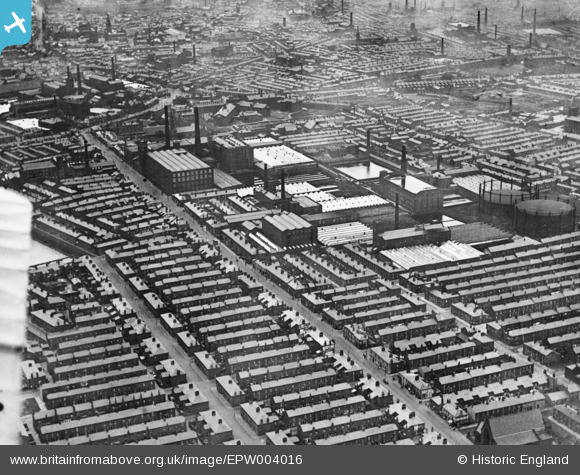
EPW004016 ENGLAND (1920). Cottom mills between Ribbleton Lane and New Hall Lane, Preston, 1920. This image has been produced from a copy-negative.
© Copyright OpenStreetMap contributors and licensed by the OpenStreetMap Foundation. 2026. Cartography is licensed as CC BY-SA.
Nearby Images (11)
EPW004016

EAW034006

EAW034004

EAW034001

EAW034002

EAW034003

EAW034005

EPW013072

EAW034000

EAW033999

EAW015900

Details
| Title | [EPW004016] Cottom mills between Ribbleton Lane and New Hall Lane, Preston, 1920. This image has been produced from a copy-negative. |
| Reference | EPW004016 |
| Date | July-1920 |
| Link | |
| Place name | PRESTON |
| Parish | |
| District | |
| Country | ENGLAND |
| Easting / Northing | 355219, 429788 |
| Longitude / Latitude | -2.679368997331, 53.762299286919 |
| National Grid Reference | SD552298 |
Pins

Preston Digital Archive |
Tuesday 5th of December 2023 03:31:45 AM | |
|
Preston Digital Archive |
Tuesday 5th of December 2023 03:31:11 AM |