
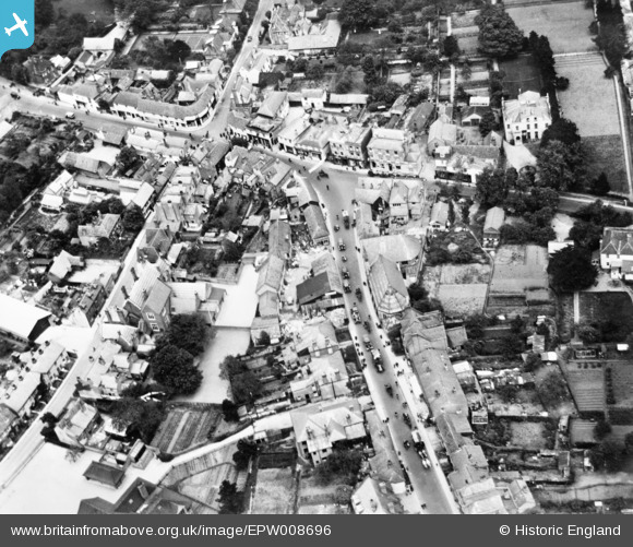
EPW008696 ENGLAND (1923). The High Street and town centre, Ewell, 1923. This image has been produced from a copy-negative.
© Copyright OpenStreetMap contributors and licensed by the OpenStreetMap Foundation. 2026. Cartography is licensed as CC BY-SA.
Nearby Images (11)
EPW008696

EPW028293

EPW008674

EPW008684

EPW008688

EPW028295

EPW028294

EPW007915

EPW006246

EPW006434

EPW028289

Details
| Title | [EPW008696] The High Street and town centre, Ewell, 1923. This image has been produced from a copy-negative. |
| Reference | EPW008696 |
| Date | 1923 |
| Link | |
| Place name | EWELL |
| Parish | |
| District | |
| Country | ENGLAND |
| Easting / Northing | 522006, 162535 |
| Longitude / Latitude | -0.24789384865916, 51.348280321741 |
| National Grid Reference | TQ220625 |
Pins
Be the first to add a comment to this image!