
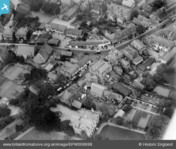
EPW008688 ENGLAND (1923). The High Street, Ewell, 1923
© Copyright OpenStreetMap contributors and licensed by the OpenStreetMap Foundation. 2026. Cartography is licensed as CC BY-SA.
Nearby Images (10)
EPW008688

EPW008684

EPW008674

EPW028293

EPW008696

EPW028294

EPW028295

EPW007915

EPW006246

EPW006434

Details
| Title | [EPW008688] The High Street, Ewell, 1923 |
| Reference | EPW008688 |
| Date | 1923 |
| Link | |
| Place name | EWELL |
| Parish | |
| District | |
| Country | ENGLAND |
| Easting / Northing | 522052, 162555 |
| Longitude / Latitude | -0.24722672231467, 51.348450212941 |
| National Grid Reference | TQ221626 |
Pins
Be the first to add a comment to this image!