
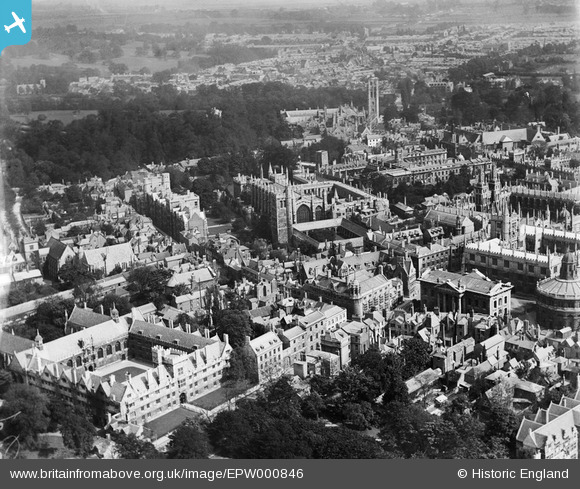
EPW000846 ENGLAND (1920). New College area, Oxford, 1920
© Copyright OpenStreetMap contributors and licensed by the OpenStreetMap Foundation. 2026. Cartography is licensed as CC BY-SA.
Nearby Images (37)
EPW000846

EAW049265

EAW049092

EAW024226

EAW049267

EAW003120

EPW022531

EAW003605

EAW049084

EAW003125

EAW003934

EPW000839

EAW049091

EAW031685

EAW045708

EAW003121

EAW003124

EAW003113

EAW024228

EPW000827

EAW024227

EAW003123

EAW045709

EAW003119

EAW003604

EAW003112

EAW031684

EPW000847

EAW003122

EPW000838

EAW013598

EPW052775

EAW003111

EPW000825

EAW049088

EPW052772

EAW013599

Details
| Title | [EPW000846] New College area, Oxford, 1920 |
| Reference | EPW000846 |
| Date | May-1920 |
| Link | |
| Place name | OXFORD |
| Parish | |
| District | |
| Country | ENGLAND |
| Easting / Northing | 451719, 206458 |
| Longitude / Latitude | -1.2506574519853, 51.753968695074 |
| National Grid Reference | SP517065 |
Pins

Alan McFaden |
Sunday 7th of December 2014 10:14:08 PM |

User Comment Contributions

Oxford Christ Church Memorial Garden |
Alan McFaden |
Sunday 7th of December 2014 10:15:34 PM |
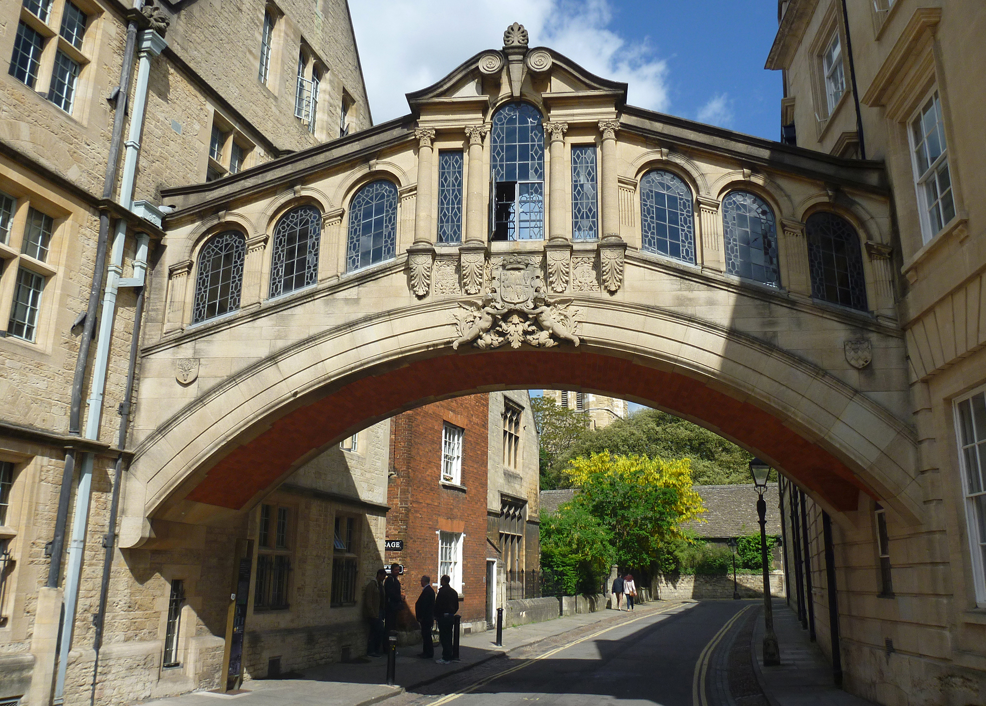
The Bridge of Sighs Oxford |
Alan McFaden |
Sunday 7th of December 2014 10:14:56 PM |