
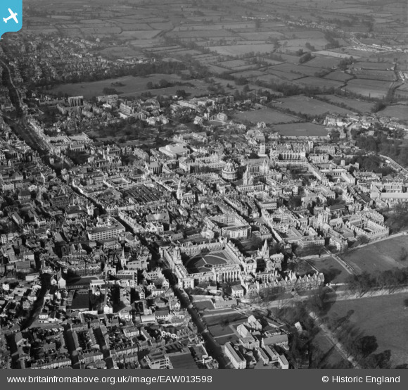
EAW013598 ENGLAND (1948). The city, Oxford, 1948
© Copyright OpenStreetMap contributors and licensed by the OpenStreetMap Foundation. 2026. Cartography is licensed as CC BY-SA.
Nearby Images (48)
EAW013598

EPW000827

EPW052775

EAW024228

EAW003112

EAW045709

EPW000838

EPW000847

EAW013599

EAW024227

EAW049091

EAW018723

EAW045708

EAW031685

EPW000839

EAW018725

EAW014891

EPW000849

EPW022524

EPW000826

EPW022531

EAW003934

EAW049084

EAW003605

EPW022527

EPW052771

EAW003120

EAW031684

EAW018724

EAW024230

EAW045716

EAW049265

EAW031682

EAW045712

EPW000845

EAW024229

EAW003118

EPW000848

EAW003123

EAW045706

EAW003122

EAW049086

EAW049267

EAW049085

EAW049087

EAW003116

EAW045710

EAW045705

Details
| Title | [EAW013598] The city, Oxford, 1948 |
| Reference | EAW013598 |
| Date | 9-March-1948 |
| Link | |
| Place name | OXFORD |
| Parish | |
| District | |
| Country | ENGLAND |
| Easting / Northing | 451524, 206314 |
| Longitude / Latitude | -1.2535038424423, 51.75269191599 |
| National Grid Reference | SP515063 |
Pins

Class31 |
Sunday 15th of May 2016 09:57:40 PM | |
|
Class31 |
Tuesday 18th of November 2014 02:49:11 PM | |

Alan McFaden |
Thursday 12th of December 2013 09:54:06 AM | |
|
Alan McFaden |
Sunday 24th of November 2013 09:37:57 PM |


