
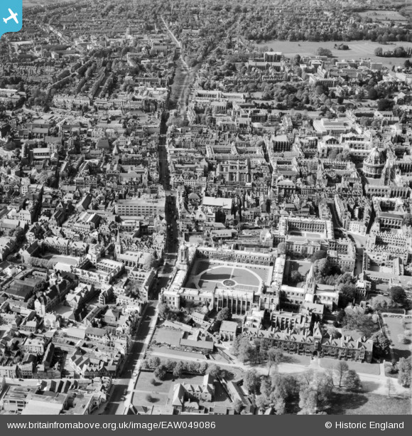
EAW049086 ENGLAND (1953). Christ Church, St Aldate's and the city, Oxford, 1953
© Copyright OpenStreetMap contributors and licensed by the OpenStreetMap Foundation. 2026. Cartography is licensed as CC BY-SA.
Nearby Images (41)
EAW049086

EAW024229

EAW049085

EAW031682

EAW045705

EPW052771

EAW045706

EPW024627

EPW038408

EPW022524

EPW000826

EAW024230

EAW047925

EPW052774

EPW000832

EAW003127

EAW014893

EAW045712

EAW045713

EAW018723

EPW000848

EAW013599

EAW014891

EPW017839

EAW018724

EPW000831

EPW000849

EPW000843

EAW018725

EPW052775

EAW013598

EAW049087

EPW000838

EPW000845

EPW022527

EPW000829

EPW022534

EPW000847

EAW045709

EPW000827

EAW049091

Details
| Title | [EAW049086] Christ Church, St Aldate's and the city, Oxford, 1953 |
| Reference | EAW049086 |
| Date | 5-May-1953 |
| Link | |
| Place name | OXFORD |
| Parish | |
| District | |
| Country | ENGLAND |
| Easting / Northing | 451402, 206129 |
| Longitude / Latitude | -1.2552986145437, 51.751039725794 |
| National Grid Reference | SP514061 |
Pins

Good Old Uncle Ted |
Wednesday 4th of March 2015 11:48:08 AM | |
|
Good Old Uncle Ted |
Wednesday 4th of March 2015 11:48:02 AM |