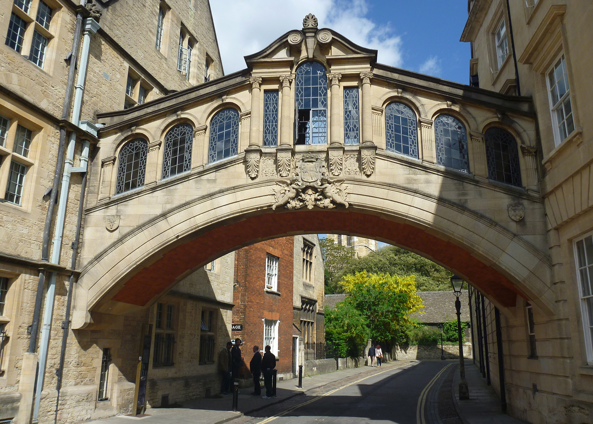
EPW000838 ENGLAND (1920). High Street, Oxford, 1920
© Copyright OpenStreetMap contributors and licensed by the OpenStreetMap Foundation. 2026. Cartography is licensed as CC BY-SA.
Nearby Images (48)
Details
| Title | [EPW000838] High Street, Oxford, 1920 |
| Reference | EPW000838 |
| Date | May-1920 |
| Link | |
| Place name | OXFORD |
| Parish | |
| District | |
| Country | ENGLAND |
| Easting / Northing | 451591, 206254 |
| Longitude / Latitude | -1.2525421199815, 51.752146266362 |
| National Grid Reference | SP516063 |
Pins

Class31 |
Tuesday 13th of October 2015 05:19:32 PM | |

Good Old Uncle Ted |
Wednesday 4th of March 2015 10:43:32 AM | |

Class31 |
Tuesday 6th of May 2014 09:48:16 AM | |

Alan McFaden |
Monday 22nd of July 2013 11:03:27 AM | |

Alan McFaden |
Monday 22nd of July 2013 11:02:21 AM |
User Comment Contributions

The Bridge of Sighs Oxford |

Alan McFaden |
Thursday 11th of December 2014 11:01:20 AM |


![[EPW000838] High Street, Oxford, 1920](http://britainfromabove.org.uk/sites/all/libraries/aerofilms-images/public/100x100/EPW/000/EPW000838.jpg)
![[EPW052775] The Radcliffe Camera and surrounding Colleges, Oxford, 1937](http://britainfromabove.org.uk/sites/all/libraries/aerofilms-images/public/100x100/EPW/052/EPW052775.jpg)
![[EPW000847] High Street, Oxford, 1920](http://britainfromabove.org.uk/sites/all/libraries/aerofilms-images/public/100x100/EPW/000/EPW000847.jpg)
![[EAW045709] Radcliffe Square and environs, Oxford, 1952. This image has been produced from a print.](http://britainfromabove.org.uk/sites/all/libraries/aerofilms-images/public/100x100/EAW/045/EAW045709.jpg)
![[EAW018725] The city, Oxford, 1948. This image has been produced from a print.](http://britainfromabove.org.uk/sites/all/libraries/aerofilms-images/public/100x100/EAW/018/EAW018725.jpg)
![[EPW000849] General view of the Radcliffe Camera and Colleges, Oxford, 1920](http://britainfromabove.org.uk/sites/all/libraries/aerofilms-images/public/100x100/EPW/000/EPW000849.jpg)
![[EPW022527] The Radcliffe Camera and environs, Oxford, 1928](http://britainfromabove.org.uk/sites/all/libraries/aerofilms-images/public/100x100/EPW/022/EPW022527.jpg)
![[EAW014891] The city centre, Oxford, 1948. This image has been produced from a print.](http://britainfromabove.org.uk/sites/all/libraries/aerofilms-images/public/100x100/EAW/014/EAW014891.jpg)
![[EAW013599] The city, Oxford, 1948](http://britainfromabove.org.uk/sites/all/libraries/aerofilms-images/public/100x100/EAW/013/EAW013599.jpg)
![[EAW018723] The city, Oxford, 1948. This image has been produced from a print.](http://britainfromabove.org.uk/sites/all/libraries/aerofilms-images/public/100x100/EAW/018/EAW018723.jpg)
![[EPW000827] The Radcliffe Camera, Bodleian Library, All Souls College, St Mary's Church and Brasenose College, Oxford, 1920](http://britainfromabove.org.uk/sites/all/libraries/aerofilms-images/public/100x100/EPW/000/EPW000827.jpg)
![[EAW013598] The city, Oxford, 1948](http://britainfromabove.org.uk/sites/all/libraries/aerofilms-images/public/100x100/EAW/013/EAW013598.jpg)
![[EAW018724] The city, Oxford, 1948. This image has been produced from a print.](http://britainfromabove.org.uk/sites/all/libraries/aerofilms-images/public/100x100/EAW/018/EAW018724.jpg)
![[EPW000826] General view of Christ Church and Radcliffe Camera, Oxford, 1920](http://britainfromabove.org.uk/sites/all/libraries/aerofilms-images/public/100x100/EPW/000/EPW000826.jpg)
![[EAW003934] Oxford Colleges, the city and Christ Church Meadow in flood, Oxford, from the north, 1947](http://britainfromabove.org.uk/sites/all/libraries/aerofilms-images/public/100x100/EAW/003/EAW003934.jpg)
![[EAW049091] The Radcliffe Camera and surrounding colleges, Oxford, 1953](http://britainfromabove.org.uk/sites/all/libraries/aerofilms-images/public/100x100/EAW/049/EAW049091.jpg)
![[EAW024228] Broad Street, High Street, the Radcliffe Camera and environs, Oxford, 1949](http://britainfromabove.org.uk/sites/all/libraries/aerofilms-images/public/100x100/EAW/024/EAW024228.jpg)
![[EAW003605] The city, Oxford, from the north-east, 1947](http://britainfromabove.org.uk/sites/all/libraries/aerofilms-images/public/100x100/EAW/003/EAW003605.jpg)
![[EAW024230] St Aldate's Street, High Street and environs, Oxford, 1949](http://britainfromabove.org.uk/sites/all/libraries/aerofilms-images/public/100x100/EAW/024/EAW024230.jpg)
![[EAW045712] The city centre, Oxford, 1952. This image has been produced from a print.](http://britainfromabove.org.uk/sites/all/libraries/aerofilms-images/public/100x100/EAW/045/EAW045712.jpg)
![[EAW003112] Oxford, Crowds around the Radcliffe Camera for the opening of the New Bodleian Library by King George VI, 1946](http://britainfromabove.org.uk/sites/all/libraries/aerofilms-images/public/100x100/EAW/003/EAW003112.jpg)
![[EAW003120] Oxford, The Oxford Colleges and crowds gathered along the High Street for the opening of the New Bodleian Library by King George VI, 1946](http://britainfromabove.org.uk/sites/all/libraries/aerofilms-images/public/100x100/EAW/003/EAW003120.jpg)
![[EPW022531] The Radcliffe Camera and surrounding Colleges, Oxford, 1928](http://britainfromabove.org.uk/sites/all/libraries/aerofilms-images/public/100x100/EPW/022/EPW022531.jpg)
![[EPW000839] The Sheldonian Theatre, Radcliffe Camera and Colleges, Oxford, 1920](http://britainfromabove.org.uk/sites/all/libraries/aerofilms-images/public/100x100/EPW/000/EPW000839.jpg)
![[EAW031685] The Radcliffe Library, the Bodleian Library and environs, Oxford, 1950](http://britainfromabove.org.uk/sites/all/libraries/aerofilms-images/public/100x100/EAW/031/EAW031685.jpg)
![[EAW045708] The Bodleian Library and environs, Oxford, 1952. This image has been produced from a print.](http://britainfromabove.org.uk/sites/all/libraries/aerofilms-images/public/100x100/EAW/045/EAW045708.jpg)
![[EAW024227] Broad Street and environs, Oxford, 1949](http://britainfromabove.org.uk/sites/all/libraries/aerofilms-images/public/100x100/EAW/024/EAW024227.jpg)
![[EAW049087] University Colleges, Oxford, 1953](http://britainfromabove.org.uk/sites/all/libraries/aerofilms-images/public/100x100/EAW/049/EAW049087.jpg)
![[EAW031682] Numerous Colleges and the town centre, Oxford, 1950](http://britainfromabove.org.uk/sites/all/libraries/aerofilms-images/public/100x100/EAW/031/EAW031682.jpg)
![[EAW049084] Broad Street and the city centre, Oxford, 1953](http://britainfromabove.org.uk/sites/all/libraries/aerofilms-images/public/100x100/EAW/049/EAW049084.jpg)
![[EPW022524] The Covered Market and environs, Oxford, 1928](http://britainfromabove.org.uk/sites/all/libraries/aerofilms-images/public/100x100/EPW/022/EPW022524.jpg)
![[EPW052771] The city centre, Oxford, from the south-east, 1937](http://britainfromabove.org.uk/sites/all/libraries/aerofilms-images/public/100x100/EPW/052/EPW052771.jpg)
![[EAW024229] High Street, St Aldate's Street and the city centre, Oxford, 1949](http://britainfromabove.org.uk/sites/all/libraries/aerofilms-images/public/100x100/EAW/024/EAW024229.jpg)
![[EAW014893] The city, Oxford, from the south-east, 1948. This image has been produced from a print.](http://britainfromabove.org.uk/sites/all/libraries/aerofilms-images/public/100x100/EAW/014/EAW014893.jpg)
![[EAW049265] Catte Street and environs, Oxford, 1953](http://britainfromabove.org.uk/sites/all/libraries/aerofilms-images/public/100x100/EAW/049/EAW049265.jpg)
![[EAW049086] Christ Church, St Aldate's and the city, Oxford, 1953](http://britainfromabove.org.uk/sites/all/libraries/aerofilms-images/public/100x100/EAW/049/EAW049086.jpg)
![[EAW045713] Christchurch, Oxford, 1952. This image has been produced from a print.](http://britainfromabove.org.uk/sites/all/libraries/aerofilms-images/public/100x100/EAW/045/EAW045713.jpg)
![[EPW000832] Christ Church, Oxford, 1920](http://britainfromabove.org.uk/sites/all/libraries/aerofilms-images/public/100x100/EPW/000/EPW000832.jpg)
![[EAW003127] The city, Oxford, from the south, 1946](http://britainfromabove.org.uk/sites/all/libraries/aerofilms-images/public/100x100/EAW/003/EAW003127.jpg)
![[EAW031684] The Radcliffe Library, the Bodleian Library and Trinity College, Oxford, 1950](http://britainfromabove.org.uk/sites/all/libraries/aerofilms-images/public/100x100/EAW/031/EAW031684.jpg)
![[EAW045706] Carfax and environs, Oxford, 1952. This image has been produced from a print.](http://britainfromabove.org.uk/sites/all/libraries/aerofilms-images/public/100x100/EAW/045/EAW045706.jpg)
![[EAW049267] Holywell Street and environs, Oxford, 1953](http://britainfromabove.org.uk/sites/all/libraries/aerofilms-images/public/100x100/EAW/049/EAW049267.jpg)
![[EAW049085] High Street and the city centre, Oxford, 1953](http://britainfromabove.org.uk/sites/all/libraries/aerofilms-images/public/100x100/EAW/049/EAW049085.jpg)
![[EPW024627] Christ Church and Oxford Cathedral, Oxford, 1928](http://britainfromabove.org.uk/sites/all/libraries/aerofilms-images/public/100x100/EPW/024/EPW024627.jpg)
![[EAW045716] Broad Street and the surrounding city, Oxford, 1952](http://britainfromabove.org.uk/sites/all/libraries/aerofilms-images/public/100x100/EAW/045/EAW045716.jpg)
![[EAW003118] Oxford, The Radcliffe Camera and surrounding Oxford Colleges on the opening day of the New Bodleian Library by King George VI, 1946](http://britainfromabove.org.uk/sites/all/libraries/aerofilms-images/public/100x100/EAW/003/EAW003118.jpg)
![[EPW038408] Christ Church and the city centre, Oxford, 1932](http://britainfromabove.org.uk/sites/all/libraries/aerofilms-images/public/100x100/EPW/038/EPW038408.jpg)
![[EAW047925] The city in the snow, Oxford, from the south, 1952](http://britainfromabove.org.uk/sites/all/libraries/aerofilms-images/public/100x100/EAW/047/EAW047925.jpg)

