
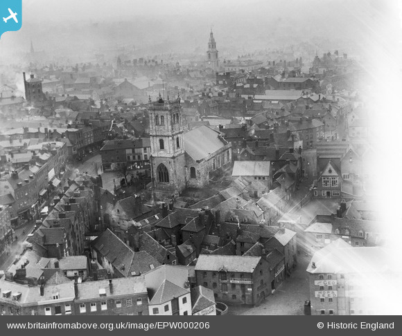
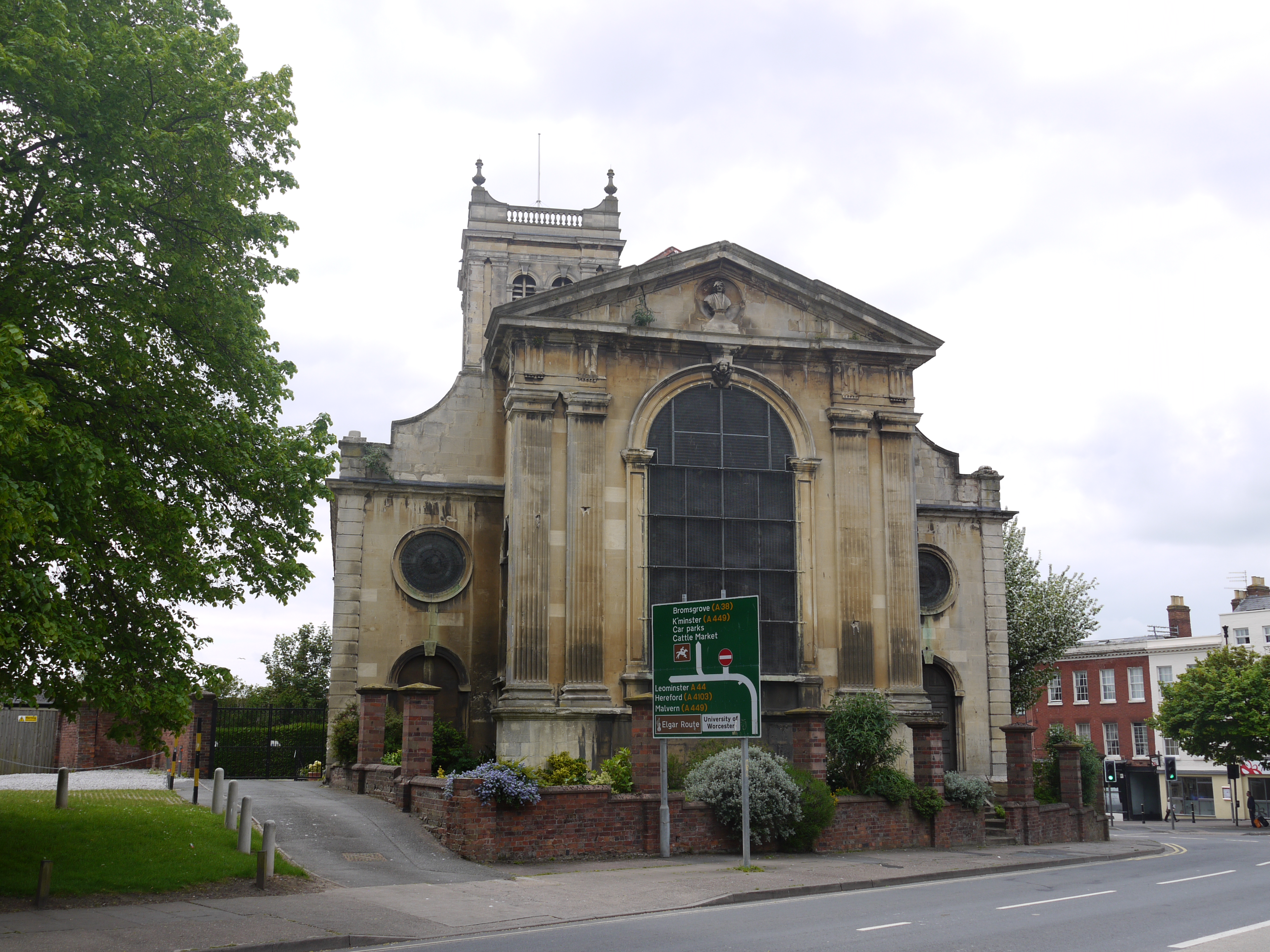
EPW000206 ENGLAND (1920). All Saints Church, Worcester, 1920
© Copyright OpenStreetMap contributors and licensed by the OpenStreetMap Foundation. 2026. Cartography is licensed as CC BY-SA.
Nearby Images (21)
EPW000206

EAW046113

EPW005384

EPW001300

EPW005380

EPW000204

EPW005407

EPW001336

EPW001301

EPW000203

EAW023846

EPW045004

EPW005406

EPW048088

EPW000211

EAW023845

EPW005383

EPW001304

EPW048089

EPW001298

EAW003989

Details
| Title | [EPW000206] All Saints Church, Worcester, 1920 |
| Reference | EPW000206 |
| Date | February-1920 |
| Link | |
| Place name | WORCESTER |
| Parish | |
| District | |
| Country | ENGLAND |
| Easting / Northing | 384778, 254862 |
| Longitude / Latitude | -2.2227041000854, 52.191385145011 |
| National Grid Reference | SO848549 |
Pins

mjmuk |
Wednesday 12th of November 2014 07:06:00 PM | |

Class31 |
Monday 18th of February 2013 05:00:45 PM | |
|
Class31 |
Monday 18th of February 2013 04:54:14 PM | |
|
Class31 |
Monday 18th of February 2013 04:53:46 PM | |
|
Class31 |
Monday 18th of February 2013 04:53:12 PM | |
|
Class31 |
Monday 18th of February 2013 04:52:56 PM | |
|
Class31 |
Monday 18th of February 2013 04:52:34 PM |
User Comment Contributions
All Saints Church, Worcester, 17/05/2016 |
Class31 |
Tuesday 17th of May 2016 11:40:40 PM |