
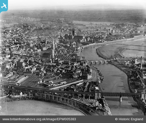
EPW005383 ENGLAND (1921). General view over the city centre, Worcester, from the north-west, 1921
© Copyright OpenStreetMap contributors and licensed by the OpenStreetMap Foundation. 2026. Cartography is licensed as CC BY-SA.
Nearby Images (9)
EPW005383

EPW001304

EPW035911

EAW046114

EPW005384

EPW001336

EPW000206

EPW001300

EPW005380

Details
| Title | [EPW005383] General view over the city centre, Worcester, from the north-west, 1921 |
| Reference | EPW005383 |
| Date | March-1921 |
| Link | |
| Place name | WORCESTER |
| Parish | |
| District | |
| Country | ENGLAND |
| Easting / Northing | 384576, 254995 |
| Longitude / Latitude | -2.2256654732241, 52.19257538357 |
| National Grid Reference | SO846550 |
