
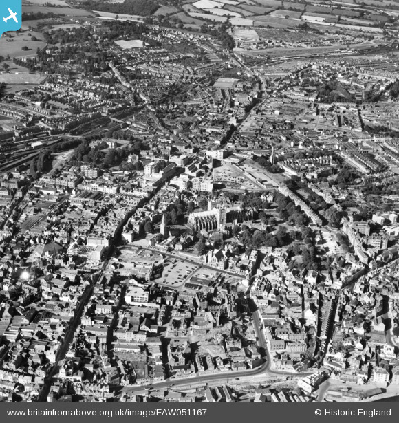
EAW051167 ENGLAND (1953). The city centre, Exeter, 1953
© Copyright OpenStreetMap contributors and licensed by the OpenStreetMap Foundation. 2026. Cartography is licensed as CC BY-SA.
Nearby Images (31)
EAW051167

EAW005853

EAW051168

EAW003659

EPW003659

EAW005854

EAW005852

EPW024108

EPW041169

EPW024083

EPW024105

EAW051163

EPW024084

EAW051165

EPW024104

EPW003657

EAW051169

EAW051164

EAW051166

EAW051162

EAW003658

EPW003658

EAW051161

EAW005856

EAW005857

EAW051172

EAW051170

EPW024103

EAW003660

EPW003660

EAW005858

Details
| Title | [EAW051167] The city centre, Exeter, 1953 |
| Reference | EAW051167 |
| Date | 6-August-1953 |
| Link | |
| Place name | EXETER |
| Parish | |
| District | |
| Country | ENGLAND |
| Easting / Northing | 292129, 92622 |
| Longitude / Latitude | -3.5283783656212, 50.722623837427 |
| National Grid Reference | SX921926 |
Pins
Be the first to add a comment to this image!