
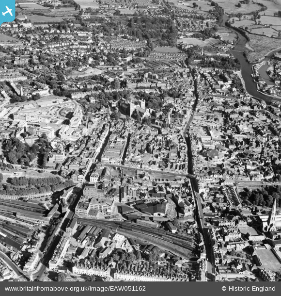
EAW051162 ENGLAND (1953). St Peter's Cathedral and the city centre, Exeter, 1953
© Copyright OpenStreetMap contributors and licensed by the OpenStreetMap Foundation. 2026. Cartography is licensed as CC BY-SA.
Nearby Images (22)
EAW051162

EPW003657

EAW003659

EPW003659

EAW003660

EPW003660

EAW005856

EAW051163

EAW051166

EAW005853

EPW024108

EAW051168

EAW051167

EAW005852

EAW005857

EAW005854

EPW024105

EPW041169

EPW024084

EAW051164

EPW024083

EAW051161

Details
| Title | [EAW051162] St Peter's Cathedral and the city centre, Exeter, 1953 |
| Reference | EAW051162 |
| Date | 10-August-1953 |
| Link | |
| Place name | EXETER |
| Parish | |
| District | |
| Country | ENGLAND |
| Easting / Northing | 291968, 92663 |
| Longitude / Latitude | -3.5306706500225, 50.72296252932 |
| National Grid Reference | SX920927 |
Pins

CBen |
Monday 20th of March 2017 11:41:26 AM |