
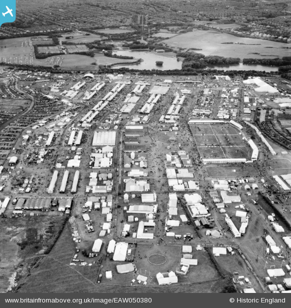
EAW050380 ENGLAND (1953). Blackpool, The Royal Agricultural Society of England Show, 1953
© Copyright OpenStreetMap contributors and licensed by the OpenStreetMap Foundation. 2026. Cartography is licensed as CC BY-SA.
Nearby Images (22)
EAW050380

EAW050602

EAW050391

EAW050388

EAW050601

EAW050390

EAW050383

EAW050382

EAW050464

EAW050385

EPW038732
, Blackpool, 1932. This image has been produced from a print.")
EPW038733
, Blackpool, 1932. This image has been produced from a print.")
EAW050377

EAW050604

EAW050386

EAW050389

EAW050379

EAW050384

EAW050462

EAW050463

EAW050603

EPW038731
, Blackpool, 1932. This image has been produced from a print.")
Details
| Title | [EAW050380] Blackpool, The Royal Agricultural Society of England Show, 1953 |
| Reference | EAW050380 |
| Date | 7-July-1953 |
| Link | |
| Place name | BLACKPOOL |
| Parish | |
| District | |
| Country | ENGLAND |
| Easting / Northing | 333548, 435648 |
| Longitude / Latitude | -3.0093545790054, 53.81265319131 |
| National Grid Reference | SD335356 |
Pins
Be the first to add a comment to this image!