
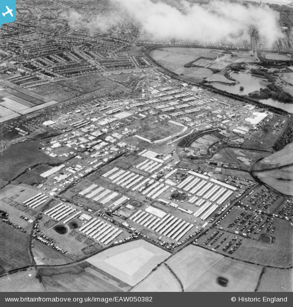
EAW050382 ENGLAND (1953). Blackpool, The Royal Agricultural Society of England Show, 1953
© Copyright OpenStreetMap contributors and licensed by the OpenStreetMap Foundation. 2026. Cartography is licensed as CC BY-SA.
Nearby Images (9)
EAW050382

EAW050383

EPW038733
, Blackpool, 1932. This image has been produced from a print.")
EAW050391

EAW050380

EPW038732
, Blackpool, 1932. This image has been produced from a print.")
EAW050388

EAW050602

EAW050393

Details
| Title | [EAW050382] Blackpool, The Royal Agricultural Society of England Show, 1953 |
| Reference | EAW050382 |
| Date | 7-July-1953 |
| Link | |
| Place name | BLACKPOOL |
| Parish | |
| District | |
| Country | ENGLAND |
| Easting / Northing | 333667, 435775 |
| Longitude / Latitude | -3.0075747462797, 53.813809811031 |
| National Grid Reference | SD337358 |
Pins

Matt Aldred edob.mattaldred.com |
Saturday 15th of May 2021 05:28:35 PM | |
|
Matt Aldred edob.mattaldred.com |
Saturday 15th of May 2021 05:23:38 PM | |
|
Matt Aldred edob.mattaldred.com |
Saturday 15th of May 2021 05:19:52 PM | |
|
Matt Aldred edob.mattaldred.com |
Saturday 15th of May 2021 05:14:14 PM | |
|
Matt Aldred edob.mattaldred.com |
Saturday 15th of May 2021 05:09:23 PM | |

Clansfolk |
Saturday 28th of June 2014 09:55:13 PM |