
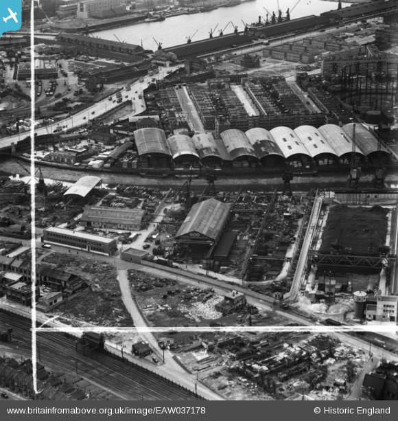
EAW037178 ENGLAND (1951). George Cohen Sons and Co Ltd Coborn Metal Works and the W.W. Howard Brothers and Co Ltd Timber Yard at Commercial Wharf, Canning Town, 1951. This image has been produced from a print marked by Aerofilms Ltd for photo editing.
© Copyright OpenStreetMap contributors and licensed by the OpenStreetMap Foundation. 2026. Cartography is licensed as CC BY-SA.
Nearby Images (26)
EAW037178

EAW035492

EAW037186

EAW035490

EAW035493

EAW035487

EAW035485

EAW035491

EAW037184

EAW037177

EAW035489

EAW035486

EAW037180

EAW035488

EAW035478

EAW037179

EAW037183

EAW037185

EAW035479

EAW035480

EAW037181

EAW035484

EAW035482

EAW035481

EAW035483

EAW035477

Details
| Title | [EAW037178] George Cohen Sons and Co Ltd Coborn Metal Works and the W.W. Howard Brothers and Co Ltd Timber Yard at Commercial Wharf, Canning Town, 1951. This image has been produced from a print marked by Aerofilms Ltd for photo editing. |
| Reference | EAW037178 |
| Date | 13-June-1951 |
| Link | |
| Place name | CANNING TOWN |
| Parish | |
| District | |
| Country | ENGLAND |
| Easting / Northing | 539065, 181636 |
| Longitude / Latitude | 0.0044378441687913, 51.516024641367 |
| National Grid Reference | TQ391816 |
Pins

Hermann the German |
Sunday 8th of October 2017 06:58:49 PM | |
|
Hermann the German |
Sunday 8th of October 2017 06:48:37 PM | |
|
Hermann the German |
Sunday 8th of October 2017 06:47:23 PM | |
|
Hermann the German |
Sunday 8th of October 2017 06:46:22 PM | |
|
Hermann the German |
Sunday 8th of October 2017 06:28:36 PM | |
|
Hermann the German |
Sunday 8th of October 2017 06:25:45 PM |