
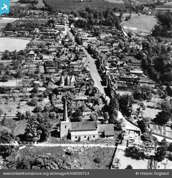
EAW036714 ENGLAND (1951). St Mary's Church and thw High Sreet, West Malling, 1951. This image has been produced from a print marked by Aerofilms Ltd for photo editing.
© Copyright OpenStreetMap contributors and licensed by the OpenStreetMap Foundation. 2026. Cartography is licensed as CC BY-SA.
Nearby Images (5)
EAW036714

EPW026082

EPW026083

EAW036715

EAW023137

Details
| Title | [EAW036714] St Mary's Church and thw High Sreet, West Malling, 1951. This image has been produced from a print marked by Aerofilms Ltd for photo editing. |
| Reference | EAW036714 |
| Date | 1-June-1951 |
| Link | |
| Place name | WEST MALLING |
| Parish | WEST MALLING |
| District | |
| Country | ENGLAND |
| Easting / Northing | 567960, 157646 |
| Longitude / Latitude | 0.4091982699952, 51.292630611663 |
| National Grid Reference | TQ680576 |
Pins
Be the first to add a comment to this image!