
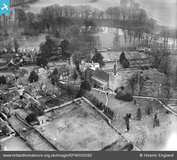
EPW026082 ENGLAND (1929). St Mary's Church and environs, West Malling, 1929
© Copyright OpenStreetMap contributors and licensed by the OpenStreetMap Foundation. 2026. Cartography is licensed as CC BY-SA.
Nearby Images (5)
EPW026082

EAW036714

EAW036710
, West Malling, 1951. This image has been produced from a print marked by Aerofilms Ltd for photo editing.")
EAW036711
, West Malling, 1951. This image has been produced from a print marked by Aerofilms Ltd for photo editing.")
EPW026084

Details
| Title | [EPW026082] St Mary's Church and environs, West Malling, 1929 |
| Reference | EPW026082 |
| Date | April-1929 |
| Link | |
| Place name | WEST MALLING |
| Parish | WEST MALLING |
| District | |
| Country | ENGLAND |
| Easting / Northing | 567915, 157533 |
| Longitude / Latitude | 0.40850025783869, 51.291628593677 |
| National Grid Reference | TQ679575 |
Pins
Be the first to add a comment to this image!