
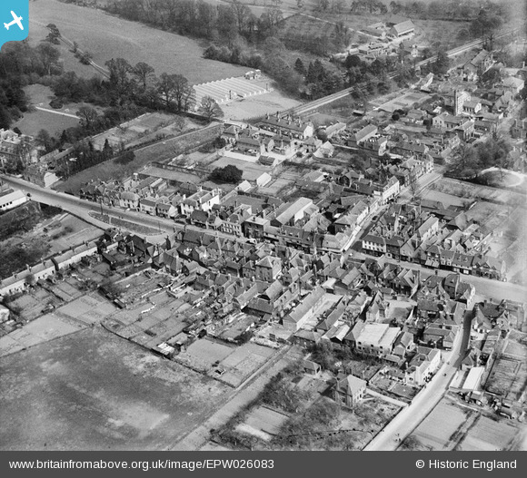
EPW026083 ENGLAND (1929). The High Street and environs, West Malling, 1929
© Copyright OpenStreetMap contributors and licensed by the OpenStreetMap Foundation. 2026. Cartography is licensed as CC BY-SA.
Nearby Images (5)
EPW026083

EAW036715

EAW036708

EAW036714

EAW036709

Details
| Title | [EPW026083] The High Street and environs, West Malling, 1929 |
| Reference | EPW026083 |
| Date | April-1929 |
| Link | |
| Place name | WEST MALLING |
| Parish | WEST MALLING |
| District | |
| Country | ENGLAND |
| Easting / Northing | 568058, 157864 |
| Longitude / Latitude | 0.41070526782065, 51.294560393206 |
| National Grid Reference | TQ681579 |
Pins

Stu Giles |
Thursday 17th of May 2018 09:18:24 AM | |
|
Kentishman |
Monday 10th of August 2015 01:09:07 PM | |
|
MalcolmH |
Friday 5th of July 2013 09:18:48 AM | |
|
MalcolmH |
Friday 5th of July 2013 09:18:12 AM |