
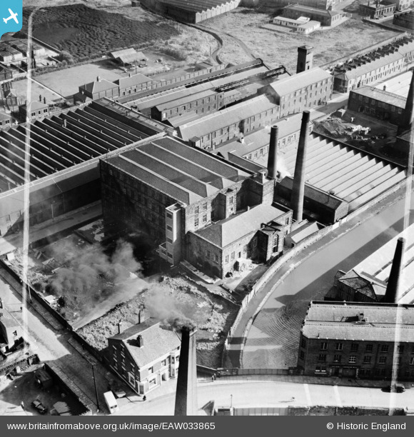
EAW033865 ENGLAND (1950). Alston Mill, Little Harwood, 1950. This image was marked by Aerofilms Ltd for photo editing.
© Copyright OpenStreetMap contributors and licensed by the OpenStreetMap Foundation. 2026. Cartography is licensed as CC BY-SA.
Nearby Images (13)
EAW033865

EAW033862

EAW033859

EAW033864

EAW033863

EAW033860

EAW033861

EAW033866

EAW025531

EAW025530

EAW025529

EPW038983

EPW038980

Details
| Title | [EAW033865] Alston Mill, Little Harwood, 1950. This image was marked by Aerofilms Ltd for photo editing. |
| Reference | EAW033865 |
| Date | 16-October-1950 |
| Link | |
| Place name | LITTLE HARWOOD |
| Parish | |
| District | |
| Country | ENGLAND |
| Easting / Northing | 369696, 428703 |
| Longitude / Latitude | -2.4596427190252, 53.753589852023 |
| National Grid Reference | SD697287 |
Pins

powerpop |
Tuesday 28th of October 2014 08:57:29 PM |