
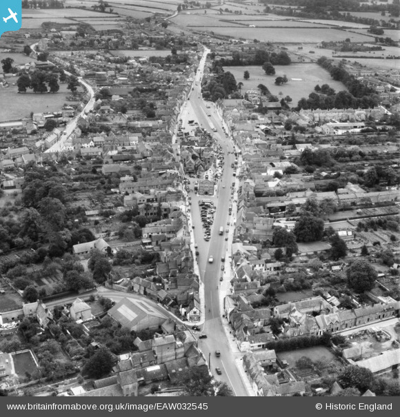
EAW032545 ENGLAND (1950). The High Street and Cornmarket, Thame, 1950
© Copyright OpenStreetMap contributors and licensed by the OpenStreetMap Foundation. 2025. Cartography is licensed as CC BY-SA.
Nearby Images (7)
EAW032545

EAW032544

EAW049099

EAW049098

EAW002765

EAW032543

EAW032559

Details
| Title | [EAW032545] The High Street and Cornmarket, Thame, 1950 |
| Reference | EAW032545 |
| Date | 12-September-1950 |
| Link | |
| Place name | THAME |
| Parish | THAME |
| District | |
| Country | ENGLAND |
| Easting / Northing | 470616, 205944 |
| Longitude / Latitude | -0.97700913696016, 51.747283434476 |
| National Grid Reference | SP706059 |
Pins
Be the first to add a comment to this image!