
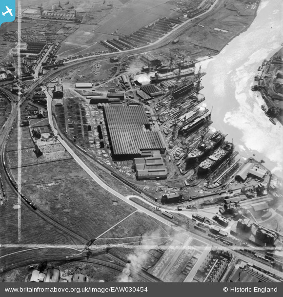
EAW030454 ENGLAND (1950). The Furness Shipbuilding Yard, Billingham, 1950. This image was marked by Aerofilms Ltd for photo editing.
© Copyright OpenStreetMap contributors and licensed by the OpenStreetMap Foundation. 2026. Cartography is licensed as CC BY-SA.
Nearby Images (12)
EAW030454

EAW030453

EPW038895

EAW024170

EAW030440

EAW030455

EAW030451

EAW030458

EAW030447

EAW030452

EAW030450

EAW030446

Details
| Title | [EAW030454] The Furness Shipbuilding Yard, Billingham, 1950. This image was marked by Aerofilms Ltd for photo editing. |
| Reference | EAW030454 |
| Date | 22-June-1950 |
| Link | |
| Place name | BILLINGHAM |
| Parish | BILLINGHAM |
| District | |
| Country | ENGLAND |
| Easting / Northing | 448456, 522365 |
| Longitude / Latitude | -1.2499760944086, 54.594023616984 |
| National Grid Reference | NZ485224 |
Pins

Dylan Moore |
Wednesday 10th of September 2014 09:30:11 PM | |
|
Dylan Moore |
Wednesday 10th of September 2014 09:29:31 PM |