
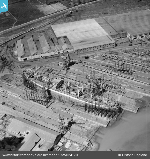
EAW024170 ENGLAND (1949). The Furness Shipbuilding Yard, Haverton Hill, 1949
© Copyright OpenStreetMap contributors and licensed by the OpenStreetMap Foundation. 2026. Cartography is licensed as CC BY-SA.
Nearby Images (16)
EAW024170

EAW030440

EPW038895

EAW030453

EAW030454

EAW030447

EAW030455

EAW030452

EAW030451

EAW030450

EPW032207

EAW030458

EPW032217

EPW032214

EPW010253

EPW032200

Details
| Title | [EAW024170] The Furness Shipbuilding Yard, Haverton Hill, 1949 |
| Reference | EAW024170 |
| Date | 23-June-1949 |
| Link | |
| Place name | HAVERTON HILL |
| Parish | BILLINGHAM |
| District | |
| Country | ENGLAND |
| Easting / Northing | 448414, 522263 |
| Longitude / Latitude | -1.2506429570718, 54.593110963293 |
| National Grid Reference | NZ484223 |
Pins
 |

J May |
Friday 9th of March 2018 07:05:38 PM |
|
MB |
Wednesday 25th of December 2013 11:00:52 AM | |
|
MB |
Wednesday 25th of December 2013 10:57:49 AM | |
|
MB |
Wednesday 25th of December 2013 10:56:36 AM |
User Comment Contributions
Slightly surprised to see the ship's boats installed at this stage of construction. The vessel appears to be a freighter |
MB |
Wednesday 25th of December 2013 10:59:36 AM |