
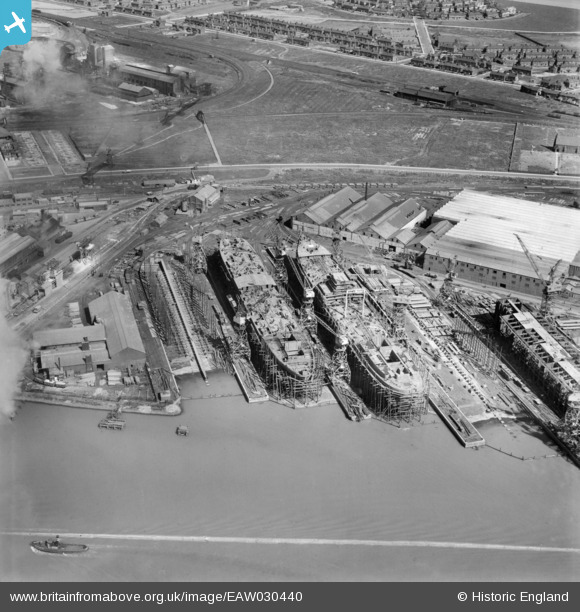
EAW030440 ENGLAND (1950). The Furness Shipbuilding Yard, Billingham, 1950. This image was marked by Aerofilms Ltd for photo editing.
© Copyright OpenStreetMap contributors and licensed by the OpenStreetMap Foundation. 2026. Cartography is licensed as CC BY-SA.
Nearby Images (16)
EAW030440

EAW024170

EPW038895

EAW030453

EAW030454

EAW030447

EAW030455

EPW032207

EAW030452

EAW030451

EPW032217

EPW032214

EPW010253

EAW030450

EPW032200

EPW032731

Details
| Title | [EAW030440] The Furness Shipbuilding Yard, Billingham, 1950. This image was marked by Aerofilms Ltd for photo editing. |
| Reference | EAW030440 |
| Date | 22-June-1950 |
| Link | |
| Place name | BILLINGHAM |
| Parish | BILLINGHAM |
| District | |
| Country | ENGLAND |
| Easting / Northing | 448376, 522263 |
| Longitude / Latitude | -1.251231069341, 54.593114602528 |
| National Grid Reference | NZ484223 |
Pins

redmist |
Thursday 23rd of January 2025 07:23:38 PM | |
|
Paul Gallon |
Tuesday 10th of March 2020 09:06:11 PM | |
|
J May |
Friday 9th of March 2018 06:20:42 PM | |

Dylan Moore |
Wednesday 10th of September 2014 09:33:36 PM | |
|
Dylan Moore |
Wednesday 10th of September 2014 09:32:53 PM | |
|
Dylan Moore |
Wednesday 10th of September 2014 09:31:51 PM |