
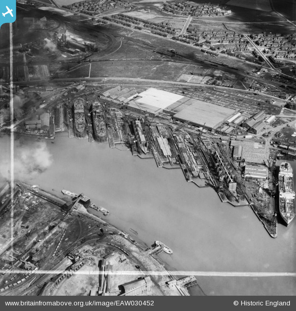
EAW030452 ENGLAND (1950). The Furness Shipbuilding Yard, Billingham, 1950. This image was marked by Aerofilms Ltd for photo editing.
© Copyright OpenStreetMap contributors and licensed by the OpenStreetMap Foundation. 2026. Cartography is licensed as CC BY-SA.
Nearby Images (17)
EAW030452

EAW030455

EAW030450

EAW030447

EAW030451

EAW030446

EAW030458

EPW038895

EAW024170

EAW030453

EAW030448

EAW030445

EAW030454

EAW030449

EAW030440

EAW030459

EAW030457

Details
| Title | [EAW030452] The Furness Shipbuilding Yard, Billingham, 1950. This image was marked by Aerofilms Ltd for photo editing. |
| Reference | EAW030452 |
| Date | 22-June-1950 |
| Link | |
| Place name | BILLINGHAM |
| Parish | BILLINGHAM |
| District | |
| Country | ENGLAND |
| Easting / Northing | 448574, 522209 |
| Longitude / Latitude | -1.2481756350603, 54.592610308183 |
| National Grid Reference | NZ486222 |
Pins
Be the first to add a comment to this image!