
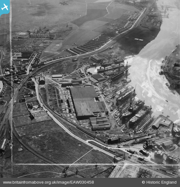
EAW030458 ENGLAND (1950). The Furness Shipbuilding Yard, Billingham, 1950. This image was marked by Aerofilms Ltd for photo editing.
© Copyright OpenStreetMap contributors and licensed by the OpenStreetMap Foundation. 2026. Cartography is licensed as CC BY-SA.
Nearby Images (19)
EAW030458

EAW030451

EAW030455

EAW030446

EAW030459

EAW030450

EAW030452

EAW030454

EAW030453

EPW038895

EAW030447

EAW030457

EAW030456

EAW030448

EAW030449

EAW030445

EAW024170

EAW030444

EAW030441

Details
| Title | [EAW030458] The Furness Shipbuilding Yard, Billingham, 1950. This image was marked by Aerofilms Ltd for photo editing. |
| Reference | EAW030458 |
| Date | 22-June-1950 |
| Link | |
| Place name | BILLINGHAM |
| Parish | BILLINGHAM |
| District | |
| Country | ENGLAND |
| Easting / Northing | 448632, 522362 |
| Longitude / Latitude | -1.2472526444581, 54.593979747989 |
| National Grid Reference | NZ486224 |
Pins

J May |
Monday 3rd of July 2017 02:21:33 PM | |
|
J May |
Monday 3rd of July 2017 02:07:49 PM | |
|
J May |
Monday 3rd of July 2017 02:04:21 PM | |
|
J May |
Monday 3rd of July 2017 02:03:27 PM | |
|
J May |
Monday 3rd of July 2017 02:02:29 PM | |
|
J May |
Monday 3rd of July 2017 02:01:55 PM | |

Dylan Moore |
Wednesday 10th of September 2014 09:36:27 PM |