
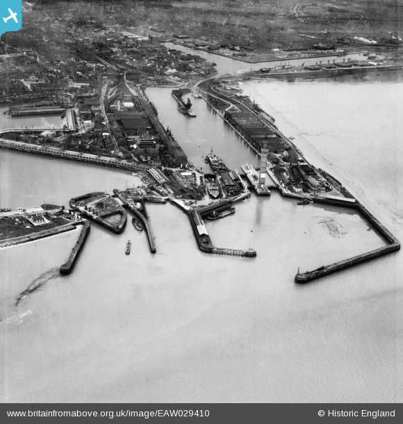
EAW029410 ENGLAND (1950). The Docks, Grimsby, 1950
© Copyright OpenStreetMap contributors and licensed by the OpenStreetMap Foundation. 2026. Cartography is licensed as CC BY-SA.
Nearby Images (22)
EAW029410

EAW029072

EAW029068

EAW029077

EAW029014

EAW029075

EAW029067

EAW029404

EAW029406

EAW029407

EAW029074

EPW012668

EAW029405

EAW029073

EAW029016

EAW029409

EPW053397

EAW029013

EAW029408

EAW029071

EAW029411

EAW029078

Details
| Title | [EAW029410] The Docks, Grimsby, 1950 |
| Reference | EAW029410 |
| Date | 5-April-1950 |
| Link | |
| Place name | GRIMSBY |
| Parish | |
| District | |
| Country | ENGLAND |
| Easting / Northing | 527975, 411355 |
| Longitude / Latitude | -0.066637180682049, 53.582904863329 |
| National Grid Reference | TA280114 |
