
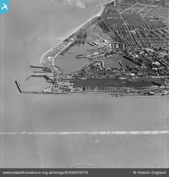
EAW029078 ENGLAND (1950). The Tidal Basin, Royal Dock and Fish Docks, Grimsby, 1950. This image was marked by Aerofilms Ltd for photo editing.
© Copyright OpenStreetMap contributors and licensed by the OpenStreetMap Foundation. 2026. Cartography is licensed as CC BY-SA.
Nearby Images (20)
EAW029078

EAW029071

EAW029070

EPW053397

EAW029073

EAW029405

EAW029016

EAW029407

EAW029406

EPW012668

EAW029404

EAW029231

EAW029013

EAW029014

EAW029068

EAW029075

EAW029077

EAW029015

EAW029410

EAW029072

Details
| Title | [EAW029078] The Tidal Basin, Royal Dock and Fish Docks, Grimsby, 1950. This image was marked by Aerofilms Ltd for photo editing. |
| Reference | EAW029078 |
| Date | 10-May-1950 |
| Link | |
| Place name | GRIMSBY |
| Parish | |
| District | |
| Country | ENGLAND |
| Easting / Northing | 527741, 411180 |
| Longitude / Latitude | -0.070241731987736, 53.581389677791 |
| National Grid Reference | TA277112 |

