
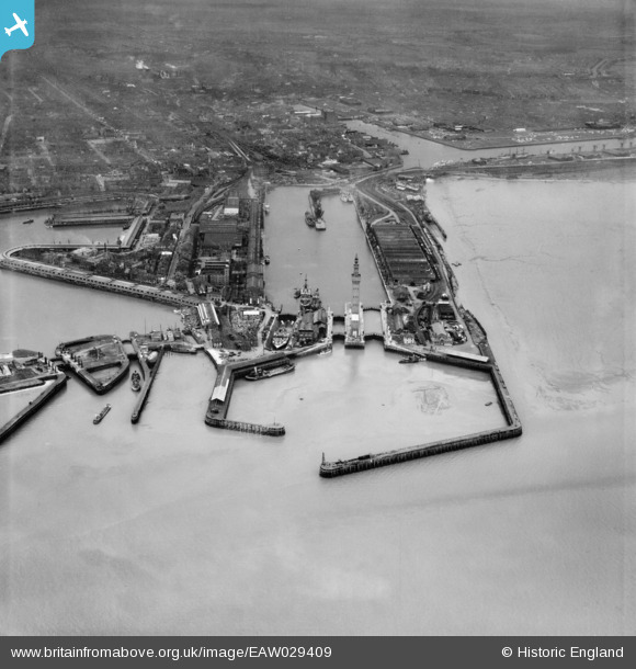
EAW029409 ENGLAND (1950). The Docks, Grimsby, from the north-east, 1950
© Copyright OpenStreetMap contributors and licensed by the OpenStreetMap Foundation. 2026. Cartography is licensed as CC BY-SA.
Nearby Images (13)
EAW029409

EAW029408

EAW029072

EAW029411

EAW029410

EAW029075

EAW029067

EAW029068

EAW029014

EAW029077

EAW029404

EPW012668

EAW029016

Details
| Title | [EAW029409] The Docks, Grimsby, from the north-east, 1950 |
| Reference | EAW029409 |
| Date | 5-April-1950 |
| Link | |
| Place name | GRIMSBY |
| Parish | |
| District | |
| Country | ENGLAND |
| Easting / Northing | 528003, 411541 |
| Longitude / Latitude | -0.066138136058374, 53.584569092508 |
| National Grid Reference | TA280115 |
