
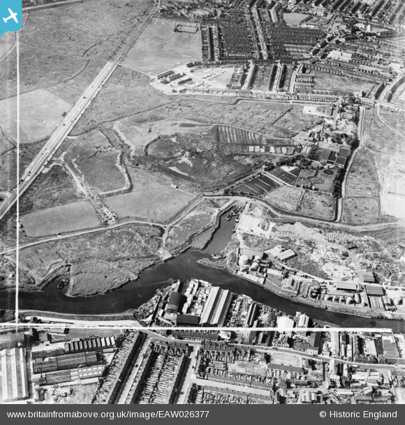
EAW026377 ENGLAND (1949). Barking Creek, Hand Trough Creek and the East Ham Sewage Works, East Ham, 1949. This image was marked by Aerofilms Ltd for photo editing.
© Copyright OpenStreetMap contributors and licensed by the OpenStreetMap Foundation. 2026. Cartography is licensed as CC BY-SA.
Nearby Images (5)
EAW026377

EAW026378
, East Ham, 1949. This image has been produced from a damaged negative.")
EAW026385

EAW026384

EPW036607

Details
| Title | [EAW026377] Barking Creek, Hand Trough Creek and the East Ham Sewage Works, East Ham, 1949. This image was marked by Aerofilms Ltd for photo editing. |
| Reference | EAW026377 |
| Date | 5-September-1949 |
| Link | |
| Place name | EAST HAM |
| Parish | |
| District | |
| Country | ENGLAND |
| Easting / Northing | 543927, 183133 |
| Longitude / Latitude | 0.075080143046418, 51.528259584859 |
| National Grid Reference | TQ439831 |
Pins

redmist |
Saturday 6th of November 2021 09:42:23 PM |