
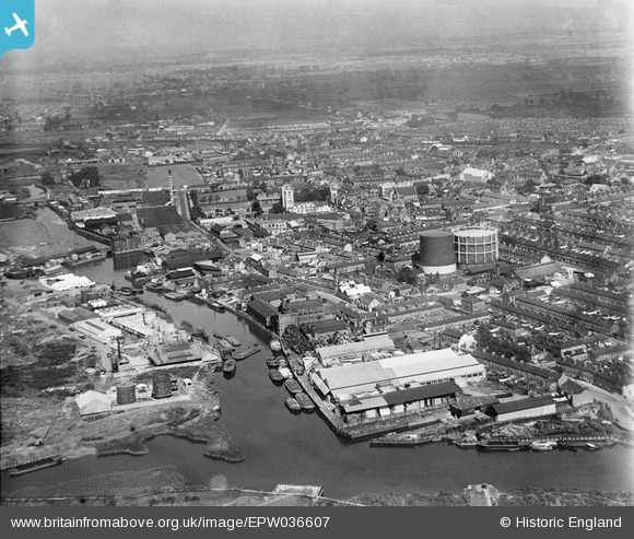
EPW036607 ENGLAND (1931). Barking Creek and the town centre, Barking, from the south, 1931
© Copyright OpenStreetMap contributors and licensed by the OpenStreetMap Foundation. 2026. Cartography is licensed as CC BY-SA.
Nearby Images (15)
EPW036607

EPW025606

EPW025608

EPW036611

EAW032568

EAW032560

EAW032561

EAW032563

EAW032564

EAW032565

EAW032567

EAW032566

EAW032562

EAW026377

EAW043567

Details
| Title | [EPW036607] Barking Creek and the town centre, Barking, from the south, 1931 |
| Reference | EPW036607 |
| Date | September-1931 |
| Link | |
| Place name | BARKING |
| Parish | |
| District | |
| Country | ENGLAND |
| Easting / Northing | 544104, 183346 |
| Longitude / Latitude | 0.077717416582617, 51.530128569595 |
| National Grid Reference | TQ441833 |
Pins
Be the first to add a comment to this image!