
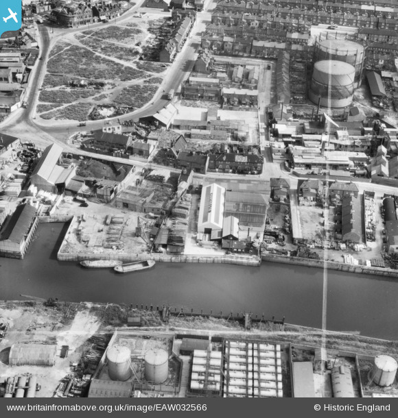
EAW032566 ENGLAND (1950). The Hortus Ltd Works between the River Roding and Abbey Road and the surrounding area, Barking, 1950. This image was marked by Aerofilms Ltd for photo editing.
© Copyright OpenStreetMap contributors and licensed by the OpenStreetMap Foundation. 2026. Cartography is licensed as CC BY-SA.
Nearby Images (15)
EAW032566

EAW032567

EAW032564

EAW032561

EAW032568

EAW032563

EAW032560

EAW032562

EAW032565

EPW036611

EAW043567

EPW025608

EPW025606

EPW036610

EPW036607

Details
| Title | [EAW032566] The Hortus Ltd Works between the River Roding and Abbey Road and the surrounding area, Barking, 1950. This image was marked by Aerofilms Ltd for photo editing. |
| Reference | EAW032566 |
| Date | 12-September-1950 |
| Link | |
| Place name | BARKING |
| Parish | |
| District | |
| Country | ENGLAND |
| Easting / Northing | 544040, 183588 |
| Longitude / Latitude | 0.076894305137065, 51.53231964644 |
| National Grid Reference | TQ440836 |
Pins

Hermann the German |
Tuesday 15th of August 2017 02:15:27 PM | |
|
Hermann the German |
Tuesday 15th of August 2017 02:13:23 PM | |
|
Hermann the German |
Tuesday 15th of August 2017 02:11:49 PM | |
|
Hermann the German |
Tuesday 15th of August 2017 02:04:49 PM | |
|
John Wass |
Tuesday 23rd of June 2015 09:52:42 PM |