
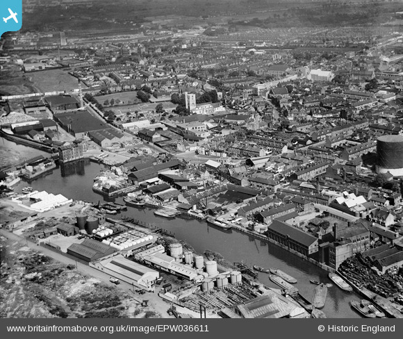
EPW036611 ENGLAND (1931). Barking Creek and the town centre, Barking, from the south-west, 1931
© Copyright OpenStreetMap contributors and licensed by the OpenStreetMap Foundation. 2026. Cartography is licensed as CC BY-SA.
Nearby Images (15)
EPW036611

EAW032560

EAW032563

EAW032561

EAW032565

EAW032568

EAW032564

EAW032566

EAW032567

EAW032562

EPW025608

EPW025606

EAW043567

EPW036607

EPW036610

Details
| Title | [EPW036611] Barking Creek and the town centre, Barking, from the south-west, 1931 |
| Reference | EPW036611 |
| Date | September-1931 |
| Link | |
| Place name | BARKING |
| Parish | |
| District | |
| Country | ENGLAND |
| Easting / Northing | 544021, 183532 |
| Longitude / Latitude | 0.076597633065415, 51.531821247592 |
| National Grid Reference | TQ440835 |
