
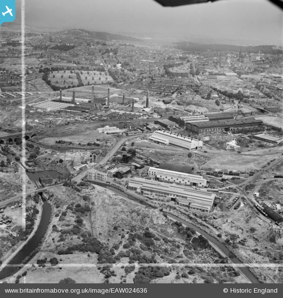
EAW024636 ENGLAND (1949). Works along Peartree Lane and environs, Netherton, from the south, 1949. This image was marked by Aerofilms Ltd for photo editing.
© Copyright OpenStreetMap contributors and licensed by the OpenStreetMap Foundation. 2026. Cartography is licensed as CC BY-SA.
Nearby Images (24)
EAW024636

EAW000682

EAW000684

EAW000686

EAW024633

EPW046056

EPW046057

EAW000683

EAW024638

EPW046059

EPW046060

EPW046055

EAW024634

EAW024637

EAW024635

EPW046058

EAW024640

EPW046061

EAW000685

EAW024639

EAW024641

EAW027691

EAW027696

EAW027697

Details
| Title | [EAW024636] Works along Peartree Lane and environs, Netherton, from the south, 1949. This image was marked by Aerofilms Ltd for photo editing. |
| Reference | EAW024636 |
| Date | 12-July-1949 |
| Link | |
| Place name | NETHERTON |
| Parish | |
| District | |
| Country | ENGLAND |
| Easting / Northing | 393537, 288747 |
| Longitude / Latitude | -2.0952088486591, 52.496224322744 |
| National Grid Reference | SO935887 |
Pins

The Circles |
Saturday 31st of May 2014 04:35:05 PM | |
|
The Circles |
Saturday 31st of May 2014 04:33:41 PM | |
|
The Circles |
Friday 30th of May 2014 11:26:12 PM |