
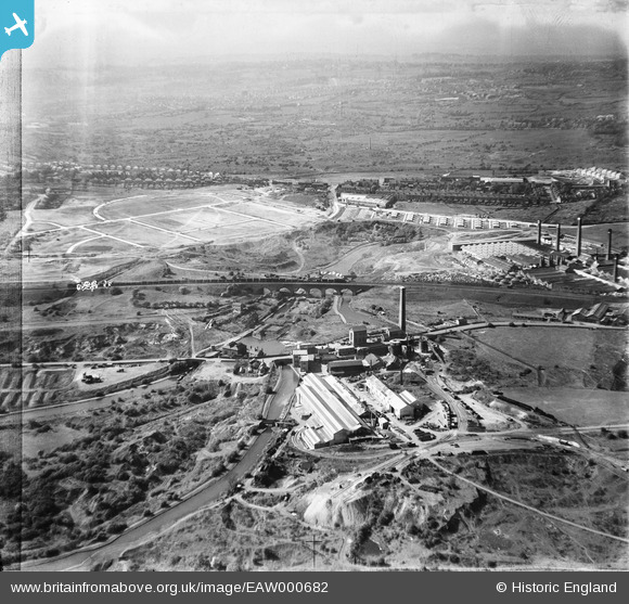
EAW000682 ENGLAND (1946). The Netherton Iron Works, the Parkhead Viaduct and the surrounding area, Netherton, from the south-east, 1946. This image has been produced from a damaged negative.
© Copyright OpenStreetMap contributors and licensed by the OpenStreetMap Foundation. 2026. Cartography is licensed as CC BY-SA.
Nearby Images (24)
EAW000682

EAW000684

EAW024636

EAW024633

EPW046056

EPW046059

EPW046060

EAW000686

EPW046057

EAW000683

EAW024637

EPW046055

EAW024638

EAW024634

EAW024635

EPW046058

EAW024640

EPW046061

EAW000685

EAW024641

EAW024639

EAW027691

EAW027696

EAW027697

Details
| Title | [EAW000682] The Netherton Iron Works, the Parkhead Viaduct and the surrounding area, Netherton, from the south-east, 1946. This image has been produced from a damaged negative. |
| Reference | EAW000682 |
| Date | 10-May-1946 |
| Link | |
| Place name | NETHERTON |
| Parish | |
| District | |
| Country | ENGLAND |
| Easting / Northing | 393567, 288749 |
| Longitude / Latitude | -2.0947669468566, 52.496242659432 |
| National Grid Reference | SO936887 |
Pins

The Circles |
Friday 30th of May 2014 11:36:58 PM | |
|
The Circles |
Friday 30th of May 2014 11:34:04 PM | |
|
Martin |
Monday 24th of March 2014 06:40:18 PM | |
|
Mr Jauncey |
Tuesday 10th of September 2013 04:16:01 PM | |
|
Mr Jauncey |
Tuesday 10th of September 2013 04:14:40 PM | |
|
Mr Jauncey |
Tuesday 10th of September 2013 04:11:14 PM | |
|
Mr Jauncey |
Tuesday 10th of September 2013 04:09:58 PM | |
|
Mr Jauncey |
Tuesday 10th of September 2013 03:56:46 PM |