
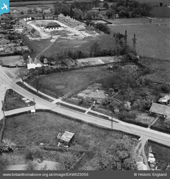
EAW023056 ENGLAND (1949). 360 Canterbury Road, the Black Horse Inn and environs, Densole, 1949
© Copyright OpenStreetMap contributors and licensed by the OpenStreetMap Foundation. 2026. Cartography is licensed as CC BY-SA.
Nearby Images (5)
EAW023056

EAW023055

EAW023054

EAW023058

EAW023057

Details
| Title | [EAW023056] 360 Canterbury Road, the Black Horse Inn and environs, Densole, 1949 |
| Reference | EAW023056 |
| Date | 10-May-1949 |
| Link | |
| Place name | DENSOLE |
| Parish | SWINGFIELD |
| District | |
| Country | ENGLAND |
| Easting / Northing | 621112, 141550 |
| Longitude / Latitude | 1.1605857489552, 51.129948081757 |
| National Grid Reference | TR211416 |
Pins

Sparky |
Friday 4th of August 2017 03:21:50 PM | |

Billy Turner |
Tuesday 16th of February 2016 12:56:54 AM | |

Paolo |
Monday 20th of January 2014 05:03:04 PM |
