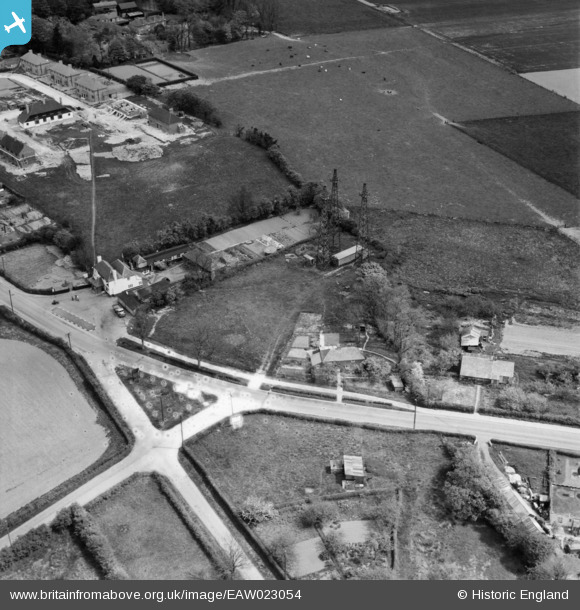
EAW023054 ENGLAND (1949). The Black Horse Inn on Canterbury Road and environs, Densole, 1949
© Copyright OpenStreetMap contributors and licensed by the OpenStreetMap Foundation. 2025. Cartography is licensed as CC BY-SA.
Nearby Images (5)
Details
| Title | [EAW023054] The Black Horse Inn on Canterbury Road and environs, Densole, 1949 |
| Reference | EAW023054 |
| Date | 10-May-1949 |
| Link | |
| Place name | DENSOLE |
| Parish | SWINGFIELD |
| District | |
| Country | ENGLAND |
| Easting / Northing | 621128, 141555 |
| Longitude / Latitude | 1.1608171487815, 51.129986801804 |
| National Grid Reference | TR211416 |
Pins

Sparky |
Monday 28th of August 2017 11:02:21 AM | |

Sparky |
Friday 4th of August 2017 03:20:17 PM | |

Billy Turner |
Tuesday 16th of February 2016 01:04:25 AM |


![[EAW023054] The Black Horse Inn on Canterbury Road and environs, Densole, 1949](http://britainfromabove.org.uk/sites/all/libraries/aerofilms-images/public/100x100/EAW/023/EAW023054.jpg)
![[EAW023056] 360 Canterbury Road, the Black Horse Inn and environs, Densole, 1949](http://britainfromabove.org.uk/sites/all/libraries/aerofilms-images/public/100x100/EAW/023/EAW023056.jpg)
![[EAW023055] The Black Horse Inn on Canterbury Road and environs, Densole, 1949](http://britainfromabove.org.uk/sites/all/libraries/aerofilms-images/public/100x100/EAW/023/EAW023055.jpg)
![[EAW023058] 360 Canterbury Road, Densole, 1949](http://britainfromabove.org.uk/sites/all/libraries/aerofilms-images/public/100x100/EAW/023/EAW023058.jpg)
![[EAW023057] Houses along Canterbury Road, Densole, 1949](http://britainfromabove.org.uk/sites/all/libraries/aerofilms-images/public/100x100/EAW/023/EAW023057.jpg)
