
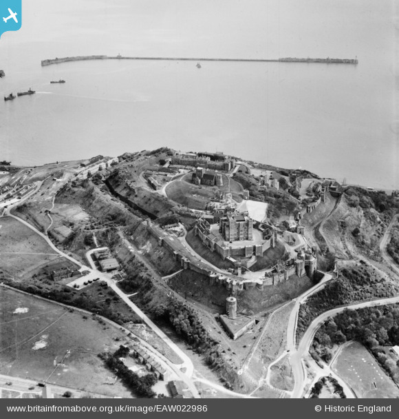
EAW022986 ENGLAND (1949). Dover Castle, Dover, 1949
© Copyright OpenStreetMap contributors and licensed by the OpenStreetMap Foundation. 2026. Cartography is licensed as CC BY-SA.
Nearby Images (16)
EAW022986

EPW017126

EPW017125

EAW007616

EPW000574

EPW000346

EAW006158

EAW007619

EAW007607

EAW006159

EAW022987

EPW000570

EPW000345

EPW000565

EPW000580

EAW007620

Details
| Title | [EAW022986] Dover Castle, Dover, 1949 |
| Reference | EAW022986 |
| Date | 6-May-1949 |
| Link | |
| Place name | DOVER |
| Parish | DOVER |
| District | |
| Country | ENGLAND |
| Easting / Northing | 632592, 141877 |
| Longitude / Latitude | 1.324603820836, 51.12833754554 |
| National Grid Reference | TR326419 |
Pins

Matt Aldred edob.mattaldred.com |
Tuesday 9th of March 2021 02:24:56 PM | |
|
Matt Aldred edob.mattaldred.com |
Tuesday 9th of March 2021 02:17:18 PM | |

The Laird |
Saturday 9th of May 2015 11:01:54 AM | |
|
The Laird |
Saturday 9th of May 2015 10:59:06 AM | |
|
cptpies |
Thursday 9th of April 2015 01:42:49 PM | |
|
cptpies |
Thursday 9th of January 2014 08:56:11 AM | |
|
cptpies |
Thursday 9th of January 2014 08:55:35 AM | |
|
jrussill |
Wednesday 8th of January 2014 06:39:54 PM |
User Comment Contributions

WW2 Pillbox |
jrussill |
Wednesday 8th of January 2014 06:40:21 PM |