
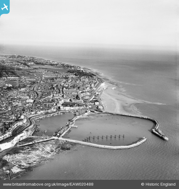
EAW020488 ENGLAND (1948). The town and harbour, Ramsgate, from the south-west, 1948
© Copyright OpenStreetMap contributors and licensed by the OpenStreetMap Foundation. 2026. Cartography is licensed as CC BY-SA.
Nearby Images (22)
EAW020488

EAW696658

EPW000380

EPW000375

EAW009010

EPW000595

EAW009008

EPW039354

EPW000598

EAW006626

EAW020487

EPW042862

EPW000091

EAW008997

EAW009007

EAW009009

EAW009024

EAW009006

EPW018653

EPW018650

EPW052885

EAW017592

Details
| Title | [EAW020488] The town and harbour, Ramsgate, from the south-west, 1948 |
| Reference | EAW020488 |
| Date | 9-November-1948 |
| Link | |
| Place name | RAMSGATE |
| Parish | RAMSGATE |
| District | |
| Country | ENGLAND |
| Easting / Northing | 638233, 164370 |
| Longitude / Latitude | 1.4200345815179, 51.327938267735 |
| National Grid Reference | TR382644 |
Pins

Alan McFaden |
Sunday 13th of July 2014 11:41:25 AM | |
|
Alan McFaden |
Sunday 13th of July 2014 11:40:50 AM | |
|
Alan McFaden |
Sunday 13th of July 2014 11:40:14 AM | |
|
Alan McFaden |
Sunday 13th of July 2014 11:39:37 AM | |
|
Alan McFaden |
Sunday 13th of July 2014 11:38:42 AM |


