
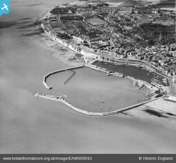
EAW009010 ENGLAND (1947). Royal Harbour and the town, Ramsgate, 1947
© Copyright OpenStreetMap contributors and licensed by the OpenStreetMap Foundation. 2026. Cartography is licensed as CC BY-SA.
Nearby Images (23)
EAW009010

EAW009008

EPW039354

EPW000598

EAW009007

EPW000091

EAW009009

EAW020487

EAW009006

EPW018650

EAW020488

EPW018653

EAW017592

EPW000375

EPW000380

EAW696658

EAW015835

EPW000595

EPW042862

EAW008999

EAW015836

EPW035449

EPW000092

Details
| Title | [EAW009010] Royal Harbour and the town, Ramsgate, 1947 |
| Reference | EAW009010 |
| Date | 12-August-1947 |
| Link | |
| Place name | RAMSGATE |
| Parish | RAMSGATE |
| District | |
| Country | ENGLAND |
| Easting / Northing | 638322, 164471 |
| Longitude / Latitude | 1.4213773556506, 51.328807633423 |
| National Grid Reference | TR383645 |
Pins

Alan McFaden |
Friday 11th of July 2014 06:22:42 PM | |
|
Alan McFaden |
Friday 11th of July 2014 06:22:22 PM | |
|
Alan McFaden |
Friday 11th of July 2014 05:42:04 PM |


