
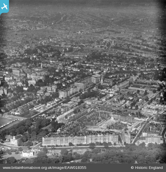
EAW018355 ENGLAND (1948). North Gate, Wellington Road and environs, St John's Wood, from the south-east, 1948. This image has been produced from a print.
© Copyright OpenStreetMap contributors and licensed by the OpenStreetMap Foundation. 2026. Cartography is licensed as CC BY-SA.
Nearby Images (14)
EAW018355

EAW018354

EPW005641

EPW027019

EPW027020

EPW027022

EPW027024

EAW044240

EPW027021

EPW027023

EPW027026

EPW027018

EAW018353

EAW044241

Details
| Title | [EAW018355] North Gate, Wellington Road and environs, St John's Wood, from the south-east, 1948. This image has been produced from a print. |
| Reference | EAW018355 |
| Date | 27-August-1948 |
| Link | |
| Place name | ST JOHN'S WOOD |
| Parish | |
| District | |
| Country | ENGLAND |
| Easting / Northing | 527078, 183128 |
| Longitude / Latitude | -0.167701093561, 51.532258816053 |
| National Grid Reference | TQ271831 |
