
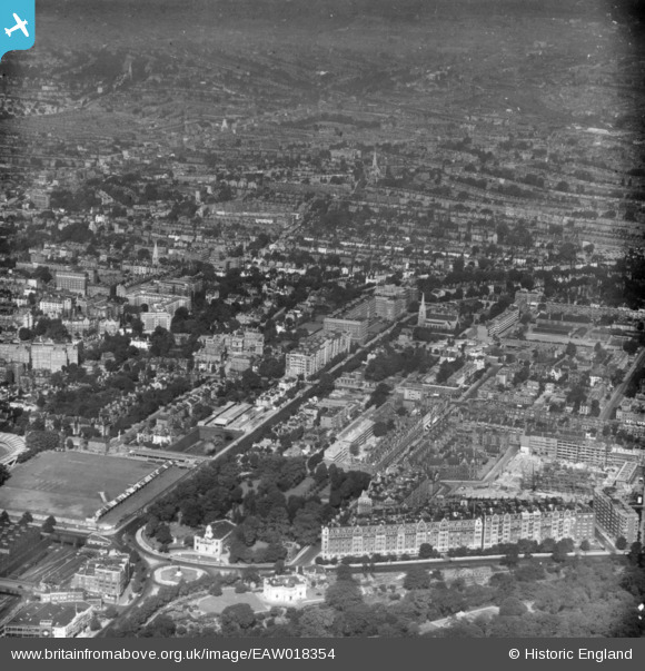
EAW018354 ENGLAND (1948). Wellington Road and environs, St John's Wood, from the east, 1948. This image has been produced from a print.
© Copyright OpenStreetMap contributors and licensed by the OpenStreetMap Foundation. 2026. Cartography is licensed as CC BY-SA.
Nearby Images (21)
EAW018354

EPW005641

EAW018355

EAW044240

EPW027019

EPW027020

EPW027022

EPW027024

EAW018353

EPW027023

EPW027021

EPW027026

EPW027018

EAW044241

EPW021969

EAW024223

EAW030526
 underway at Lord's Cricket Ground, 1950")
EPW039574

EAW006466

EAW015849

EAW030528
 underway at Lord's Cricket Ground, 1950")
Details
| Title | [EAW018354] Wellington Road and environs, St John's Wood, from the east, 1948. This image has been produced from a print. |
| Reference | EAW018354 |
| Date | 27-August-1948 |
| Link | |
| Place name | ST JOHN'S WOOD |
| Parish | |
| District | |
| Country | ENGLAND |
| Easting / Northing | 527063, 183027 |
| Longitude / Latitude | -0.16795370578476, 51.531354419134 |
| National Grid Reference | TQ271830 |
Pins
Be the first to add a comment to this image!