
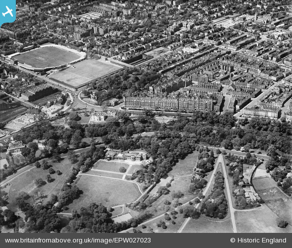
EPW027023 ENGLAND (1929). North Gate, Lord's Cricket Ground and Regent's Park, St John's Wood, 1929
© Copyright OpenStreetMap contributors and licensed by the OpenStreetMap Foundation. 2026. Cartography is licensed as CC BY-SA.
Nearby Images (13)
EPW027023

EPW027021

EPW027026

EPW027024

EPW027022

EPW027020

EPW027019

EPW027018

EPW027025

EAW044240

EPW005641

EAW018354

EAW018355

Details
| Title | [EPW027023] North Gate, Lord's Cricket Ground and Regent's Park, St John's Wood, 1929 |
| Reference | EPW027023 |
| Date | May-1929 |
| Link | |
| Place name | ST JOHN'S WOOD |
| Parish | |
| District | |
| Country | ENGLAND |
| Easting / Northing | 527261, 182979 |
| Longitude / Latitude | -0.16511778414645, 51.530878400586 |
| National Grid Reference | TQ273830 |
Pins

John W |
Tuesday 15th of November 2016 04:46:06 PM | |

Class31 |
Wednesday 8th of October 2014 12:38:44 PM | |
|
Captaintee |
Thursday 24th of July 2014 01:59:10 PM | |
This was originally Marlborough Road station, and was renamed St John's Wood in 1939. The original St John's Wood Road station was by Lord's Cricket ground, this was closed at the same time when the Bakerloo line was extended to Stanmore using a pair of the Metropolitan lines. |
John W |
Tuesday 15th of November 2016 05:05:53 PM |
|
Captaintee |
Thursday 24th of July 2014 01:50:40 PM | |
|
Class31 |
Monday 3rd of March 2014 11:42:07 AM |


User Comment Contributions
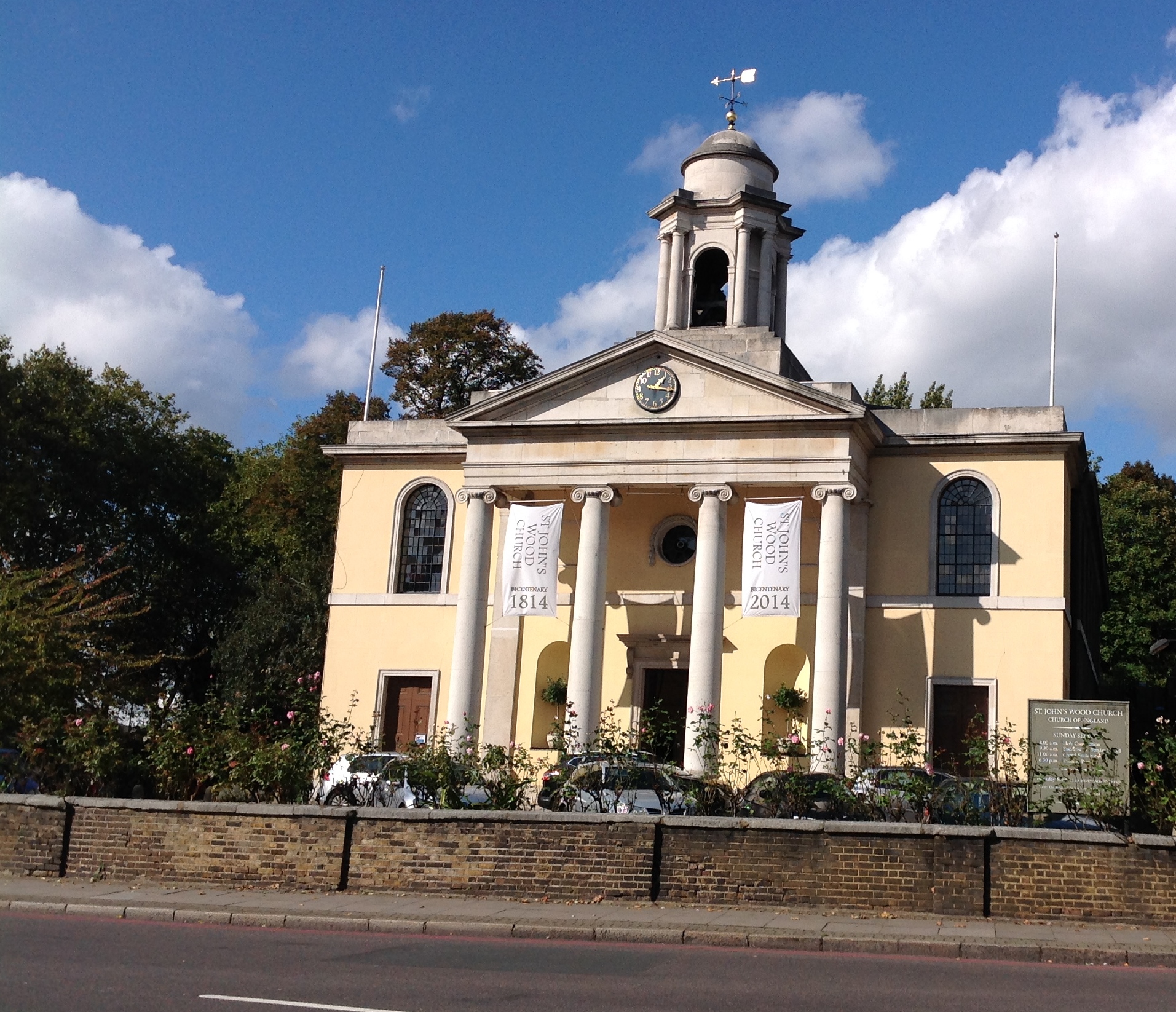
St John's Wood Church, 07/10/2014 |
Class31 |
Wednesday 8th of October 2014 12:28:10 PM |