
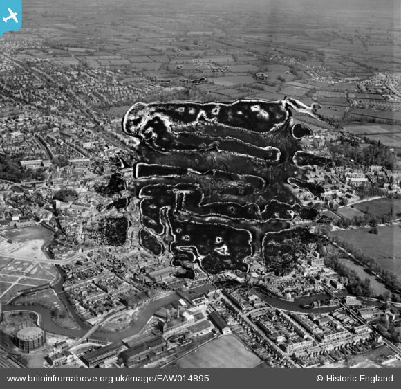
EAW014895 ENGLAND (1948). The city, Oxford, from the south, 1948. This image has been produced from a damaged negative.
© Copyright OpenStreetMap contributors and licensed by the OpenStreetMap Foundation. 2026. Cartography is licensed as CC BY-SA.
Nearby Images (9)
EAW014895

EPW000821

EAW003606

EPW038406

EAW014894

EPW038407

EAW047926

EPW000829

EPW024626

Details
| Title | [EAW014895] The city, Oxford, from the south, 1948. This image has been produced from a damaged negative. |
| Reference | EAW014895 |
| Date | 26-April-1948 |
| Link | |
| Place name | OXFORD |
| Parish | |
| District | |
| Country | ENGLAND |
| Easting / Northing | 451192, 205670 |
| Longitude / Latitude | -1.258408364813, 51.746931921557 |
| National Grid Reference | SP512057 |
Pins

Andy from Abingdon on Thames |
Saturday 4th of January 2014 09:48:52 PM | |
|
Andy from Abingdon on Thames |
Saturday 4th of January 2014 09:47:40 PM | |
|
Andy from Abingdon on Thames |
Saturday 4th of January 2014 09:43:41 PM |