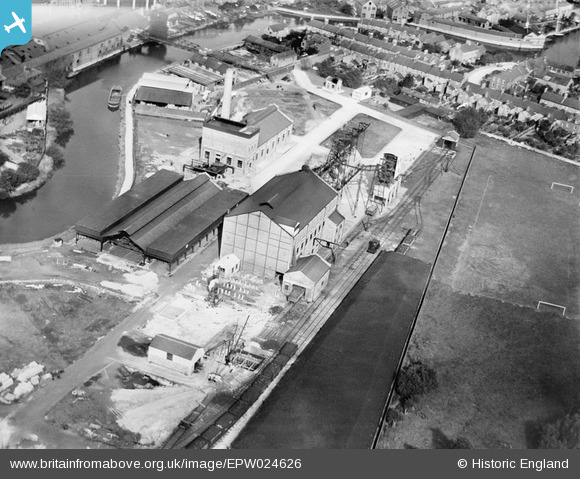
EPW024626 ENGLAND (1928). The Oxford Gas Company Works, Oxford, 1928
© Copyright OpenStreetMap contributors and licensed by the OpenStreetMap Foundation. 2026. Cartography is licensed as CC BY-SA.
Details
| Title | [EPW024626] The Oxford Gas Company Works, Oxford, 1928 |
| Reference | EPW024626 |
| Date | September-1928 |
| Link | |
| Place name | OXFORD |
| Parish | |
| District | |
| Country | ENGLAND |
| Easting / Northing | 451024, 205435 |
| Longitude / Latitude | -1.2608763589146, 51.744834276154 |
| National Grid Reference | SP510054 |
Pins
User Comment Contributions
Is this the Canal basin ? |

Steve Warner |
Thursday 7th of March 2013 02:53:15 PM |
i don't think it is |

Memory Lane |
Thursday 7th of March 2013 02:53:15 PM |


![[EPW024626] The Oxford Gas Company Works, Oxford, 1928](http://britainfromabove.org.uk/sites/all/libraries/aerofilms-images/public/100x100/EPW/024/EPW024626.jpg)
![[EPW000841] View over Oxford from Grandpont, Oxford, from the south-west, 1920](http://britainfromabove.org.uk/sites/all/libraries/aerofilms-images/public/100x100/EPW/000/EPW000841.jpg)
![[EAW014895] The city, Oxford, from the south, 1948. This image has been produced from a damaged negative.](http://britainfromabove.org.uk/sites/all/libraries/aerofilms-images/public/100x100/EAW/014/EAW014895.jpg)
![[EPW000821] View over Oxford and Christ Church Meadows, Oxford, from the west, 1920](http://britainfromabove.org.uk/sites/all/libraries/aerofilms-images/public/100x100/EPW/000/EPW000821.jpg)