
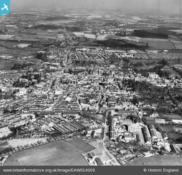
EAW014000 ENGLAND (1948). The town, Colchester, from the south, 1948
© Copyright OpenStreetMap contributors and licensed by the OpenStreetMap Foundation. 2026. Cartography is licensed as CC BY-SA.
Nearby Images (17)
EAW014000

EAW029727

EPW001858

EPW018554

EAW015358

EPW001861

EAW024676

EAW043688

EAW029726

EAW043687

EAW029728

EAW037255

EAW037496

EAW029725

EAW037498

EAW043690

EAW029724

Details
| Title | [EAW014000] The town, Colchester, from the south, 1948 |
| Reference | EAW014000 |
| Date | 23-March-1948 |
| Link | |
| Place name | COLCHESTER |
| Parish | |
| District | |
| Country | ENGLAND |
| Easting / Northing | 599612, 224819 |
| Longitude / Latitude | 0.90084551731657, 51.885696571318 |
| National Grid Reference | TL996248 |
Pins

Stephen Mirrington |
Tuesday 30th of September 2025 06:49:28 PM | |
|
redmist |
Sunday 28th of January 2024 11:50:02 AM | |

keithb |
Wednesday 8th of April 2015 09:24:41 PM | |
|
keithb |
Wednesday 8th of April 2015 09:00:15 PM | |
|
PrezAlan |
Monday 16th of March 2015 09:36:06 PM | |
|
PrezAlan |
Monday 16th of March 2015 09:35:11 PM | |
|
PrezAlan |
Monday 16th of March 2015 09:33:54 PM | |
|
PrezAlan |
Monday 16th of March 2015 09:33:09 PM | |
|
PrezAlan |
Monday 16th of March 2015 09:33:04 PM | |
|
PrezAlan |
Saturday 14th of March 2015 03:25:52 PM |

