
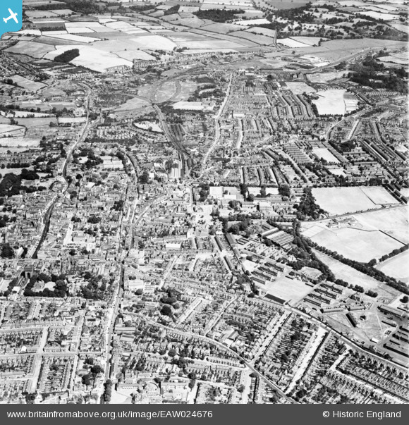
EAW024676 ENGLAND (1949). The town, Colchester, 1949
© Copyright OpenStreetMap contributors and licensed by the OpenStreetMap Foundation. 2026. Cartography is licensed as CC BY-SA.
Nearby Images (12)
EAW024676

EAW015358

EPW018554

EPW018548

EPW018557

EAW029727

EAW014000

EAW037496

EPW001858

EAW043690

EAW029728

EAW043689

Details
| Title | [EAW024676] The town, Colchester, 1949 |
| Reference | EAW024676 |
| Date | 11-July-1949 |
| Link | |
| Place name | COLCHESTER |
| Parish | |
| District | |
| Country | ENGLAND |
| Easting / Northing | 599774, 224796 |
| Longitude / Latitude | 0.90318318922427, 51.885431998153 |
| National Grid Reference | TL998248 |
Pins

Stephen Mirrington |
Tuesday 30th of September 2025 08:34:09 PM | |
|
Stephen Mirrington |
Tuesday 30th of September 2025 08:33:34 PM | |
|
Stephen Mirrington |
Tuesday 30th of September 2025 08:32:33 PM | |
|
Stephen Mirrington |
Tuesday 30th of September 2025 08:27:05 PM | |
|
Richard |
Monday 29th of June 2015 10:08:00 PM | |

Maurice |
Wednesday 23rd of July 2014 05:39:43 AM |