
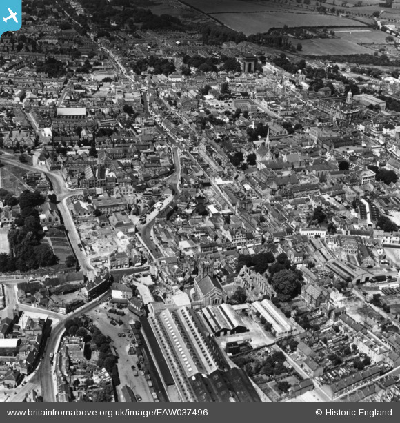
EAW037496 ENGLAND (1951). Osborne Street and the town centre, Colchester, 1951. This image has been produced from a print.
© Copyright OpenStreetMap contributors and licensed by the OpenStreetMap Foundation. 2026. Cartography is licensed as CC BY-SA.
Nearby Images (19)
EAW037496

EAW029728

EPW018548

EAW037498

EPW018557

EAW024676

EAW037499

EAW015358

EAW029727

EPW001858

EPW058740

EPW018545

EAW037495

EPW018554

EAW037255

EAW015360

EAW014000

EAW037258

EPW018546

Details
| Title | [EAW037496] Osborne Street and the town centre, Colchester, 1951. This image has been produced from a print. |
| Reference | EAW037496 |
| Date | 2-July-1951 |
| Link | |
| Place name | COLCHESTER |
| Parish | |
| District | |
| Country | ENGLAND |
| Easting / Northing | 599834, 224955 |
| Longitude / Latitude | 0.90414601927698, 51.886838372262 |
| National Grid Reference | TL998250 |
Pins

Stephen Mirrington |
Wednesday 1st of October 2025 09:39:04 AM |