
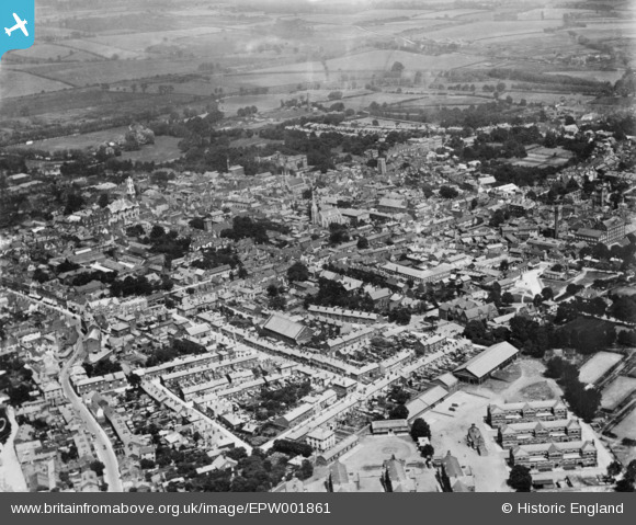
EPW001861 ENGLAND (1920). The town, Colchester, from the south-west, 1920. This image has been produced from a copy-negative.
© Copyright OpenStreetMap contributors and licensed by the OpenStreetMap Foundation. 2026. Cartography is licensed as CC BY-SA.
Nearby Images (15)
EPW001861

EAW029726

EAW043687

EAW014000

EAW043688

EAW014001

EPW001858

EAW029727

EPW001855

EAW029725

EPW018554

EPW001856

EAW015358

EAW029724

EAW037255

Details
| Title | [EPW001861] The town, Colchester, from the south-west, 1920. This image has been produced from a copy-negative. |
| Reference | EPW001861 |
| Date | June-1920 |
| Link | |
| Place name | COLCHESTER |
| Parish | |
| District | |
| Country | ENGLAND |
| Easting / Northing | 599485, 224836 |
| Longitude / Latitude | 0.8990122814569, 51.885894693826 |
| National Grid Reference | TL995248 |
Pins
Be the first to add a comment to this image!