
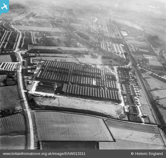
EAW013311 ENGLAND (1948). Rolls Royce Factory off Pym's Lane, Crewe, 1948
© Copyright OpenStreetMap contributors and licensed by the OpenStreetMap Foundation. 2026. Cartography is licensed as CC BY-SA.
Nearby Images (11)
EAW013311

EAW013301

EAW013309

EAW013310

EAW013302

EAW013304

EAW013308

EAW013307

EAW013303

EAW013305

EAW013312

Details
| Title | [EAW013311] Rolls Royce Factory off Pym's Lane, Crewe, 1948 |
| Reference | EAW013311 |
| Date | 12-February-1948 |
| Link | |
| Place name | CREWE |
| Parish | |
| District | |
| Country | ENGLAND |
| Easting / Northing | 368465, 356421 |
| Longitude / Latitude | -2.4710743611739, 53.103755058756 |
| National Grid Reference | SJ685564 |
Pins

Matt Aldred edob.mattaldred.com |
Thursday 7th of March 2024 02:40:15 PM | |

SteveB |
Wednesday 18th of August 2021 10:16:19 AM |