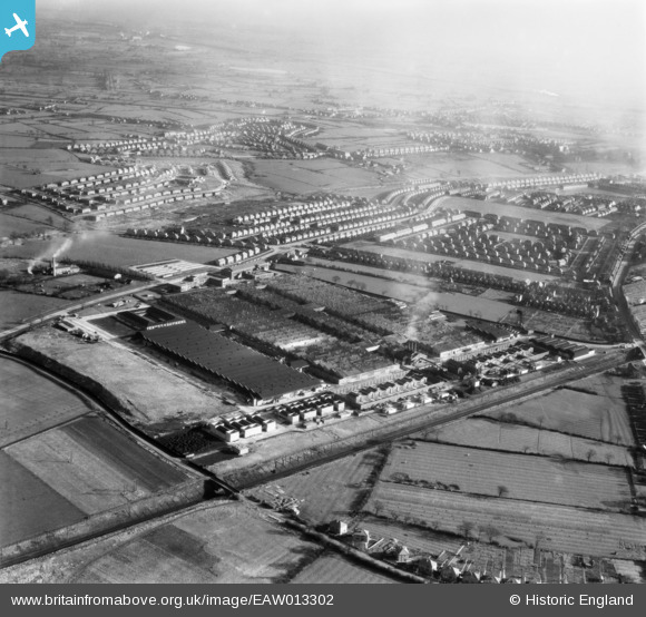
EAW013302 ENGLAND (1948). Rolls Royce Factory off Pym's Lane and environs, Crewe, 1948
© Copyright OpenStreetMap contributors and licensed by the OpenStreetMap Foundation. 2025. Cartography is licensed as CC BY-SA.
Nearby Images (11)
Details
| Title | [EAW013302] Rolls Royce Factory off Pym's Lane and environs, Crewe, 1948 |
| Reference | EAW013302 |
| Date | 12-February-1948 |
| Link | |
| Place name | CREWE |
| Parish | |
| District | |
| Country | ENGLAND |
| Easting / Northing | 368573, 356472 |
| Longitude / Latitude | -2.4694660930883, 53.104219909415 |
| National Grid Reference | SJ686565 |


![[EAW013302] Rolls Royce Factory off Pym's Lane and environs, Crewe, 1948](http://britainfromabove.org.uk/sites/all/libraries/aerofilms-images/public/100x100/EAW/013/EAW013302.jpg)
![[EAW013301] Rolls Royce Factory off Pym's Lane, Crewe, 1948](http://britainfromabove.org.uk/sites/all/libraries/aerofilms-images/public/100x100/EAW/013/EAW013301.jpg)
![[EAW013303] Rolls Royce Factory off Pym's Lane and environs, Crewe, from the north-east, 1948](http://britainfromabove.org.uk/sites/all/libraries/aerofilms-images/public/100x100/EAW/013/EAW013303.jpg)
![[EAW013311] Rolls Royce Factory off Pym's Lane, Crewe, 1948](http://britainfromabove.org.uk/sites/all/libraries/aerofilms-images/public/100x100/EAW/013/EAW013311.jpg)
![[EAW013304] Rolls Royce Factory off Pym's Lane, Crewe, 1948](http://britainfromabove.org.uk/sites/all/libraries/aerofilms-images/public/100x100/EAW/013/EAW013304.jpg)
![[EAW013307] Rolls Royce Factory off Pym's Lane, Crewe, from the north, 1948](http://britainfromabove.org.uk/sites/all/libraries/aerofilms-images/public/100x100/EAW/013/EAW013307.jpg)
![[EAW013305] Rolls Royce Factory off Pym's Lane, Crewe, from the north, 1948](http://britainfromabove.org.uk/sites/all/libraries/aerofilms-images/public/100x100/EAW/013/EAW013305.jpg)
![[EAW013312] Rolls Royce Factory off Pym's Lane, Crewe, from the north-east, 1948. This image has been produced from a print.](http://britainfromabove.org.uk/sites/all/libraries/aerofilms-images/public/100x100/EAW/013/EAW013312.jpg)
![[EAW013310] Rolls Royce Factory off Pym's Lane, Crewe, 1948](http://britainfromabove.org.uk/sites/all/libraries/aerofilms-images/public/100x100/EAW/013/EAW013310.jpg)
![[EAW013309] Rolls Royce Factory off Pym's Lane, Crewe, 1948](http://britainfromabove.org.uk/sites/all/libraries/aerofilms-images/public/100x100/EAW/013/EAW013309.jpg)
![[EAW013306] Rolls Royce Factory off Pym's Lane, Crewe, from the north-east, 1948](http://britainfromabove.org.uk/sites/all/libraries/aerofilms-images/public/100x100/EAW/013/EAW013306.jpg)
