
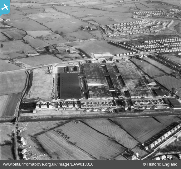
EAW013310 ENGLAND (1948). Rolls Royce Factory off Pym's Lane, Crewe, 1948
© Copyright OpenStreetMap contributors and licensed by the OpenStreetMap Foundation. 2026. Cartography is licensed as CC BY-SA.
Nearby Images (9)
EAW013310

EAW013309

EAW013311

EAW013301

EAW013302

EAW013308

EAW013304

EAW013307

EAW013305

Details
| Title | [EAW013310] Rolls Royce Factory off Pym's Lane, Crewe, 1948 |
| Reference | EAW013310 |
| Date | 12-February-1948 |
| Link | |
| Place name | CREWE |
| Parish | |
| District | |
| Country | ENGLAND |
| Easting / Northing | 368374, 356445 |
| Longitude / Latitude | -2.4724360458679, 53.103965426043 |
| National Grid Reference | SJ684564 |
